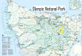
Solo-backpacking 4 passes in NE Olympics (22-25 Sept
2011)
(Cameron Pass, Lost Pass, & Gray Wolf Pass. Side
Trips to Hayden Pass, Sentinel Peak, Thousand Acre Meadows, & Cedar
Lake)
----- Backpacking about 38 miles with 10750 ft elev
gain & Side trips about 13 miles with 4000 ft elev gain
(A total of 51
miles with 14,750 ft elev gain in 3.25 days)
Much anticipated 2011 summer was over last Thursday (22 Sept). Looking at my past 2011 outdoor activities, I have been enjoying some of the best times in outdoor activities in my life. I was gone most of the weekend for Cross Country skiing, climbing, hiking, backpacking, & kayaking. However, for my primary objectives of hiking and backpacking in 2011, I felt like I have not done much of those this year as much as I would like to, maybe, because I did not cross out hiking trails as much as I did last year. Also, I had 4 wish lists for 3-5 days of backpacking trips in Olympics but have not done any of those (Grand Loop, Enchanted Loop, Dodger Point Loop, & Skyline Loop). I wanted to do at least one of 4 wish lists.
The weather suddenly seemed to turn to a rainy season two weeks ago (12 Sept) but eased off on the following week. Then, the following weekend for my trip, the weather looked good with Temp 50-70F which are superb for hiking/backpacking. I enjoyed my first solo-hike in Olympics one week earlier (Heather Park & Lake Angeles Loop), so my solo-dayhike was a prelude to this solo-backpacking trip. I decided to backpack one of my wishlists: the Grand Loop in 3 days (as Mike Woodmansee recommended in his book, "Trekking Washington".) Since I day-hiked the Grand Pass & Badger valley Loop last year, I decided to modify the loop and added a few side trips such as Hayden Pass, Sentinel Peak, Thousand Acre Meadows, & Cedar Lake. I estimated that the trip would be about 45 miles with 14000 ft elev gain. It was quite an aggressive multi-days backpacking trip for a beginner like me, but I felt that I have ample experiences and backpacking skills as I have backpacked a few overnighters and 4 days of backpacking in North Cascades 3 weeks ago. And most importantly, I felt very confident and strong for doing such mileages on the well established trails.
A couple of hikers were interested in my trip itinerary but neither of them was able to join me. Originally, it was a full 3 days of trip but I was little concerned with the first day of backpacking 18 miles, especially with the first 4.1 miles of downhill (Trail is called the Three Forks). I knew that I could do it but did not like the first 4.1 miles of downhill with 3200 ft elev loss (Deer Park to Gray Wolf Camp site). Downhill sometimes give me temporary knee pains. If I had a knee pain in the first 4 miles, I might not feel good for the rest of the day, maybe, for the rest of the trip. So, I decided to take little more time and cautious by getting to the Gray Wolf camp site after work on Thursday. I was familiar with the Gray Wolf camp area since I recently day hiked the area. At the Gray Wolf Camp site, Gray Wolf river, Cameron creek, and Grand Creek merge into one, the Gray Wolf river. I ended up spending the night at the shelter. Luckily, there was no bug or rodent.
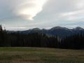
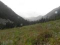
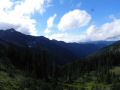
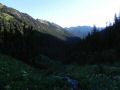
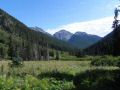
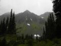
For the trip, it was simply amazing to backpack the North East (NE) interiors of the Olympic National Park, WA. I was very satisfied with my trip itinerary seeing those prestigious Passes (Cameron, Lost, Hayden, & Gray Wolf) with one short backpacklng trip. Yes, the sceneries were quite amazing and a lot different from the dayhiking trips. In simple words, the view of the Mother Nature's landscape was truly mesmerizing with the color mixture of blue & white (sky), brown & blue (tarns & lakes), white (snow), gray (shale & rock), green (vegetation), etc.
I have included highlights of my trips with a couple of selected photos, and then included my backpacking story with the full pictures.
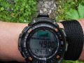
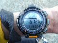
Here were the highlights of my trip (I used its technical specifications as a reference for my trip. Prior to the trip, they are derived and estimated from a green trail map, and some are corrected with my calibrated altimeter watch after the trip):
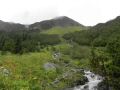
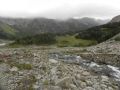
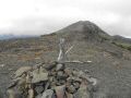
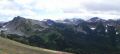
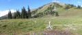
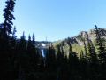
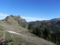
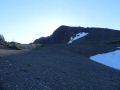
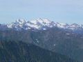
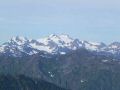
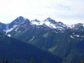
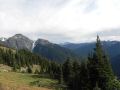
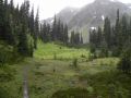
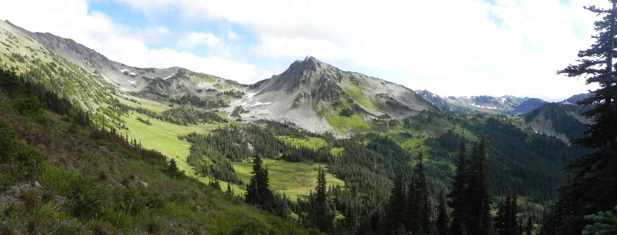
.My wife told me that this picture looked
like a painting !!! A Southly view of the Lost Basin, Lost
Peak, Partial Thousand Acre Meadows, Sentinel Peak, & Hayden Pass
(barely) can be seen.
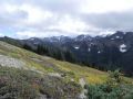
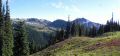
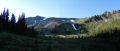
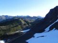
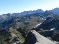
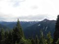
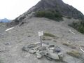
A Northly View from the Sentinel Peak
(6592 ft elev): Hayden Pass (very left), Hayden Pass Basin, Lost Pass/Peak, Lost Basin,
Cameron Pass/Mountain, and partial Thousand Acre Meadows can be seen. 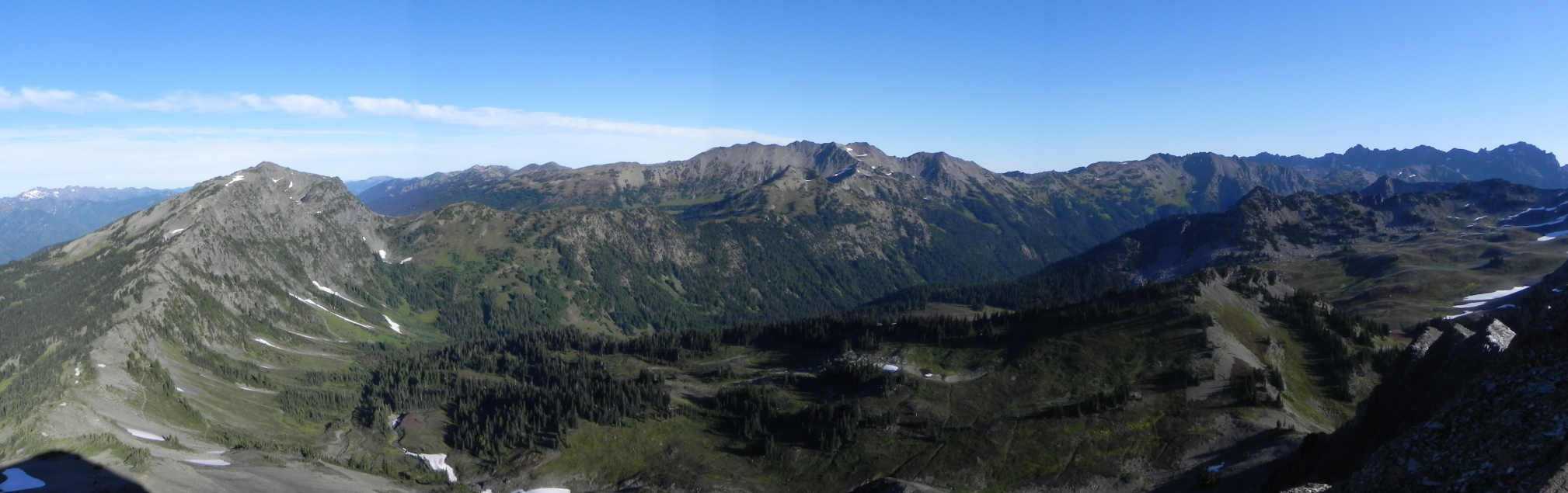
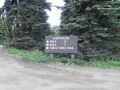
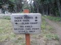
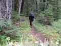
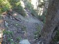
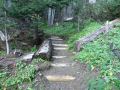
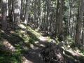
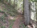
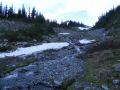
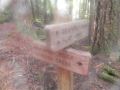
Day 1: Deer Park to Three Forks Junction. ---- (Backpacking 4.1 miles with
3200 ft elev loss. Side Trips: Blue Mountain. Drove around the Deer
Park)
***
Trail: Three Forks trail. Trail condition was excellent. No down
tree.
Technical specifications:
Deer Park (5400 ft elev): 0
miles
To 3 Folks (2200 ft elev) junction: 4.1
miles
--- (Day 1: 4.1 miles with 3200 ft elev loss. Side Trips: Blue
Mountain. Drove around the Deer Park)
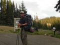
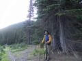
From the Deer Park, underway for the first solo-backpacking
trip..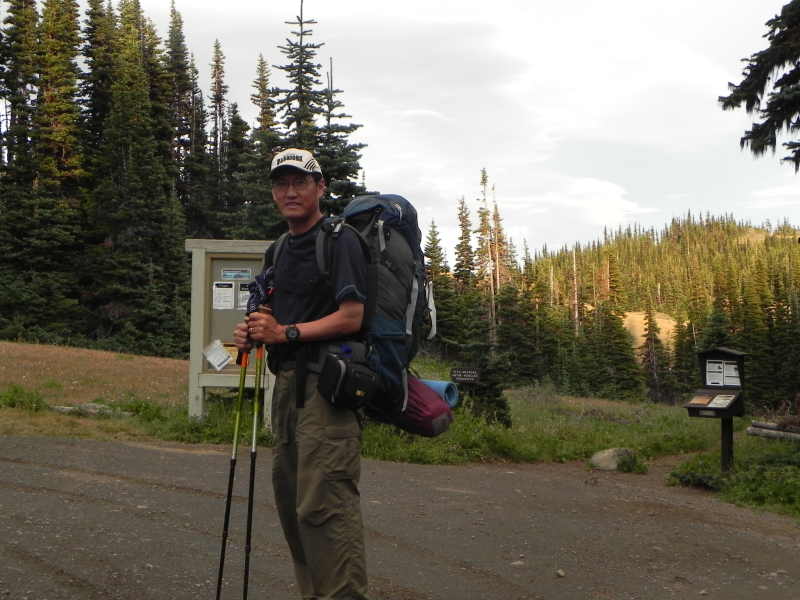
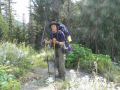
On the previous night, slept about 6-7 hours at home. Started Strength 10 (1-10 good) and ended with 10. Started spirit 8 and ended with 10 (1-10 good). My starting spirit was not at high since I felt sorry to my family and it was a solo trip (I always enjoy and like to hike/backpack with others).
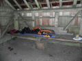
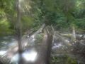
I left the Deer Park at 1840 and arrived at the Gray Wolf camp site at 2000. I basically ran down the hill as it was getting dark quickly. I used a headlamp for about half of the trails, The 4.1 mile trail is called the Three Forks Trail. The decent to 3 forks junction is simply dropping into a deep hole (continuous 3200 ft drop in 4.1 miles !) through forest into a deep and timbered canyon. Upon arrival at the shelter, Gray Wolf Camp site, I decided to stay the night at the shelter since there was 40% chance of rain before 2300. The shelter was excellent (study and clean). I hung my belongings on the wire hooks and nails. Luckily, there was no bug or rodent. Good AM 950 radio station at the camp site.
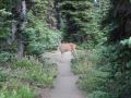
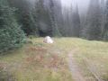
The highlights of the day was driving around the Deer Park to see the trailhead to the Obstruction Point and the ranger station, and was greeted by three deer.
|
|
|
|
|
|
|
|
|
|
|
|
|
|
|
|
|
|
|
|
|
|
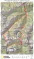
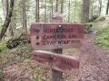
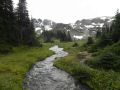
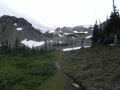
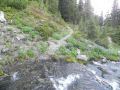
Day 2: Gray Wolf Camp site to Grand Pass Junction to Cameron Pass Lost
Pass to Dosewallips Meadow. ---- (Backpacking 13.3 miles with 4300 ft elev gain.
Side Trip: None.)
*** Trails:
Cameron Creek Trail - Cameron Pass - Cameron Pass trail - Lost Pass -Dosey Meadow.
All the trails were excellent. No down tree.
Technical specifications:
Three Forks (2200 ft elev) junction: 0
miles (Total)
to Shelter (3100 ft elev)-destroyed: 4.9
miles (4.9 miles)
to Grand Pass Junction (4150 ft elev) : 2.1
miles (7.0 miles)
to Cameron Pass (6500 ft elev): 3.5
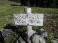
miles (10.5 miles)
To Lost Pass (5570 ft elev): 1.9
miles (12.4 miles)
* Low point between Lost Peak (6515 ft) and
Mt Claywood (6836 ft)
* Lost Basin (5350 ft elev)
To Dosey
Meadow Junction (4450 ft elev):
0.9 miles (13.3 miles)
--- (Day 2: 13.3 miles with 4300 ft elev gain. Side
Trip: None.) (Actual elevation gains are slightly higher since the Cameron
Creek Trails had many up and downs.)
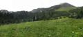
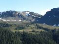
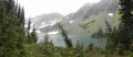
A Cameron Basin view on the way up to the Cameron
Pass (6500 ft elev)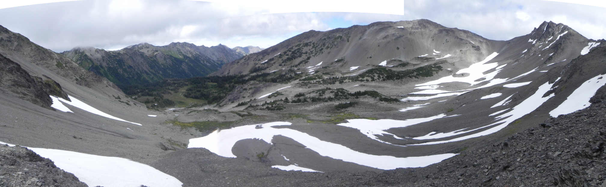
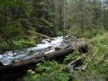
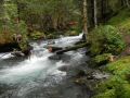
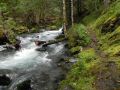
Slept about 4-5 hours at the Gray Wolf Shelter. Started Strength 10 (1-10 good) and ended with 5. Started spirit 10 and ended with 10 (1-10 good). Left the Gray Wolf Camp site at 0750 and arrived at the Dosy Meadow 1540. 8 hours of backpacking for the day.
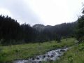
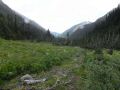
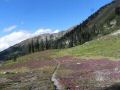
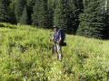
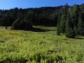
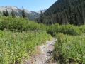
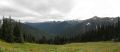
I woke up to a decent day, nice and cool for hiking. I could see a faint blue sky through the dark forest canopy. Through the night, I was half awake due to roaring 3 forks noise and unknown fear in the dark, except for falling asleep deep 0130-0430. Temp (mid 50s-60s) was just right for the hiking comfort level and no bugs. It sprinkled a very short moment on the way up to the Grand Pass Junction. I felt very strong in the morning. And my spirit was alive as I did not feel good on the day before leaving my family behind and doing a solo trip. I was striding up fast to a shelter (4.9 miles away from the 3 Forks). The shelter was totally collapsed and several posts were on the ground (had a flat spot for camping with a creek nearby). I took 5 minutes break there. Then, I hiked to the Grand Pass Junction. I thought that the junction (4150 ft elev) would be a high country with the open views, but I was still in the wood. I kept on moving toward the Cameron Pass. It was quite tough going up Cameron Basin (5700 ft elev) to the Cameron Pass (6430 ft elev). Well, all the passes and mountains climbing are usually quite tough with steep switchbacks. Shale trail was nice but the wind on the face was very strong that tried to knock me over a few times. Upon arriving at the Cameron Pass, I got out of there quickly because it was too windy. I was planning to summit an unnamed peak on the West that Robert Wood talked about but decided to skip it. On the way down to the Lost Basin, the wind died down, and the view of the Lost Pass (trail was visible), Lost Peak and the surroundings were spectacular (at that time I did not know but I could guess the places.). Upon arriving at the Loss Pass, I dropped my pack and took some time to admire the beauty of the surroundings and looked back at the Cameron Pass. It was tempting to summit the Lost Peak, but the clouds and possible strong wind stopped me. Then, I continued to drop down to the Dosy Meadow (almost 900 ft drop in 0.9 miles !). Here, I saw a tent (a sign of people) right next to the bear wire. Also, I saw two backpackers in the distance going toward the Hayden Pass. I quickly setup my tent next to the 2nd bear wire. Ate dinner and laid down for the next day. Re-read a couple of paragraphs of the Robert Wood's book, then listened to my radio. Had a couple of good AM radio stations at the Dosey Meadow.
The highlights of the day was seeing the Cameron Basin, Cameron Pass, Lost Basin, Lost Pass, and Dosy Meadows.
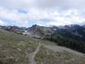
From Gray Wolf Shelter to Grand Pass Junction to Cameron Pass:
|
|
|
|
|
|
|
|
|
|
|
|
|
|
|
|
|
|
|
|
|
|
|
|
|
|
|
|
|
|
|
|
|
|
|
|
|
|
|
|
|
|
|
|
|
|
|
|
|
|
|
|
|
|
|
From Cameron Pass to Lost Pass to Dosy Meadows Camp site:
|
|
|
|
|
|
|
|
|
|
|
|
|
|
|
|
|
|
|
|
|
|
|
|
|
|
|
|
|
|
|
|
|
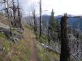
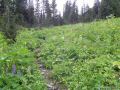
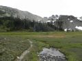
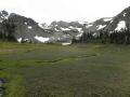
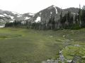
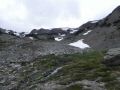
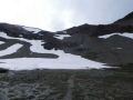
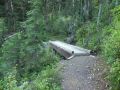
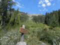
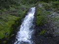
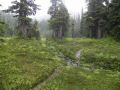
Day 3: Dosy Meadow to Cedar Lake Junction (Gray Wolf Fall). Side
trips to Hayden Pass, Sentinel Peak, & Thousand Acre Meadows. ----
(Backpacking 11 miles with 3250 ft elev gain. Side trip: 8.3 miles with 3000 ft elev
gain.)
*** Trails: Dosewallips
River Trail - Gray Wolf Pass - Gray Wolf River Trail - Gray Wolf Fall (Junction
to Cedar Lake). All the trails were excellent. Only one down tree on the
Gray Wolf Pass trail.
Technical specifications:
Side trips:
Dosey Meadow camp site (4450
ft elev): 0
miles (Total)
To Hayden pass (5850 ft elev): 2.3
miles (2.3 miles)
To Sentinel Peak (6592 ft elev): 1
miles (3.3 miles)
To Unnamed Peak (6150 ft, SE of the Thousand Acre Meadow)
2 miles (4.3 miles)
To Thousand
Acre Meadow (5250- 5550 ft elev) 1
miles (6.3 miles)
To Dosey Meadow camp site 2
miles (8.3 miles)
(Side Trips: 8.3 miles with 3000 ft elev gain)
Backpacking:
Dosey Meadow camp site (4450 ft elev): 0
miles (Total)
to Bear Camp (3844 ft elev): 1.7
miles (1.7 miles)
to Dosy Junction with Gray Wolf Pass (3600 ft elev): 1.7
miles (3.4 miles)
to Gray Wolf Pass (6541 ft elev): 3.5
miles (6.9 miles)
to Cedar lake Junction (4200 ft elev):
4.1
miles (11 miles)
--- (Day 3: 11 miles with 3250 ft elev gain. Side
trip: 8.3 miles with 3000 ft elev gain.)
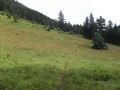
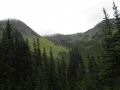
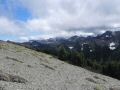
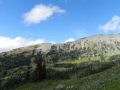
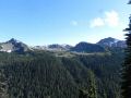
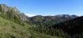
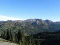
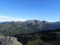
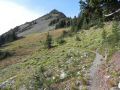
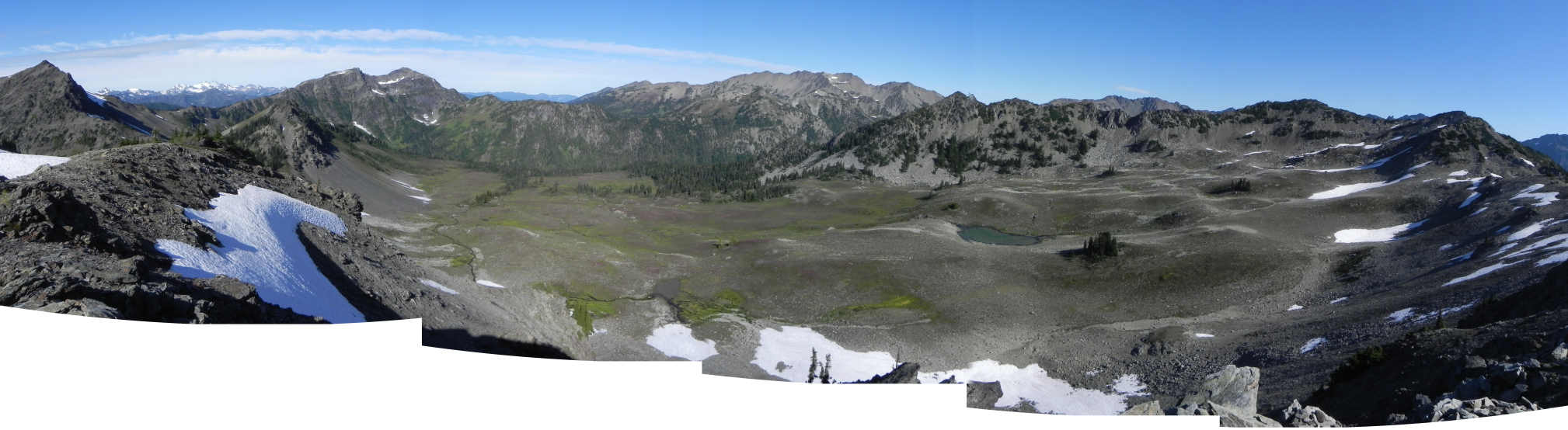
A NW view of the Thousand Acre Meadows (5250-5500 ft elev) from an unnamed peak (6150 ft elev).
Sentinel Peak, Mt Olympus, Hayden Pass, Lost Pass, Cameron Pass/Mountain
...
Slept about 6-7 hours at the Dosy Meadow (without rain fly). It was pleasant weather with breeze. A couple of skeeters but was not bad. 13 hours (1730 - 0630) of resting in the tent. Started Strength 9 (1-10 good) and ended with 3. Started spirit 10 and ended with 10 (1-10 good). 0800-1900: 12 hours of both side trips and backpacking for the day.
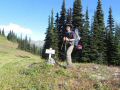
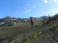
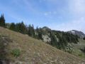
It was a near perfect day (all blue, no fog in the morning, and reasonably clear day). A long exciting day was ahead of me: multiple side trips and backpaking to the Cedar Lake. Had a good breakfast and packed up everything, except for a water bottle, camera, and tripod. Hung my backpack on the bear wire and left for the side trips (Hayden Pass, Sentinel Peak, & Thousand Acre Meadows).
a. Side Trips to Hayden pass, Sentinel Peak, unnamed Peak, & Thousand
Acre Meadows.
Hiking up 2.3 miles from Dosy Meadows to the Hayden
Pass (5850 ft elev) was steep (1350 ft elev gain) but pleasant with just a day
pack (water & camera). It only took 1 hr 20 minutes. At the
basin, I took a couple of pictures of the camp site that Robert Wood mentioned
in his book. At the Hayden pass, the views to the Cameron and Lost Passes
were fun to look at and fulfilling since I could now name them. The
Thousand Acre Meadows was not visible as it was hidden behind a peak (I could
guess the place looking at the map.). At
the Hayden Pass, I hiked up to the Sentinel Peak (6592 ft. class I) via SE talus
ridge that took only 20-25 minutes.
At the Peak, I could see 360 degrees of the unobstructed views:
Cameron Pass, Lost Pass, Hayden Pass, partial Thousand Acre Meadows, Mt Olympus,
and the others (that I am not familiar with). At the Sentinal Peak,
I figured out the routes (off trails) to the 1000 Acre Meadows: basically
side hilled
toward the 1000 Acre Meadows going around an unnamed peak and down to a small
meadow next (south) to the Meadows. At the 1000 Acre Meadows rim, I decided to peak another peak
(no name, 6150 ft) climbing about 500-600 ft (class II traversing to the side
of the Mt and class I to the top). At the unnamed peak, I spent
about 10 minutes admiring the views, walked down to the 1000 acre meadows, and
went around the peak (that blocked the view from the Hayden Pass) to be back
on the Hayden Pass trail, and back to the Dosy Meadow camp site. Left
the camp site at 0720 and arrived back at 1200. It was near 5 hours trip
which took a lot more than I expected. Rested and snacked for 20
minutes at the Dosy Meadow camp site.
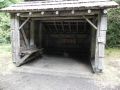
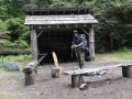
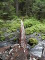
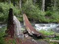
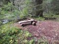
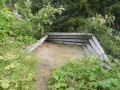
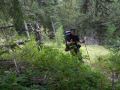
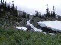
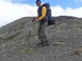
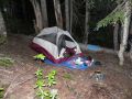
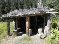
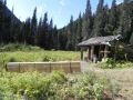
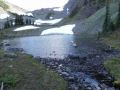
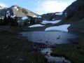
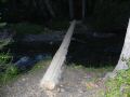
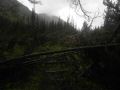
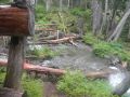
b. My next goal was backpacking down to the Dosy Junction, up to the Gray Wolf Pass, and down to the Cedar Lake via way trail. I quickly arrived at the Bear Camp site with a shelter (1.7 miles away from Dosy Meadow) along the Dosewallips River Trail. The shelter was dilapidating. Next to the shelter, there were the new cedar flanks and roofing materials for shelter renovation. While walking around the camp site, I suddenly felt bowl movement and had a diarrhea. A few possible causes were on my mind: ate the snacks too much in short time, drank unfiltered water, & contaminated hands (unwashed hands after scrambling mountain). Hiking down another 1.7 miles to the Dosy junction (w/ Gray wolf pass) was quite easy, but mostly exposed on the hot sun. Then at 1345, I stated climbing up 3.5 miles from Dosy junction (3750 ft elev) to the Gray Wolf Pass (6541 ft elev). About 1/3 way up, I was getting tired and felt weak. I thought that it was probably due to dehydration since I drank only 2L of water for the day and earlier diarrhea. I did not have urge to drink. But I tried to hydrate by taking a couple of sips every 15-20 minutes. My legs had enough power but I was breathing heavily. My upper body (shoulders) had very little power so I could not pull myself up the steep trail with my shoulders. About half way up, I felt dizzy and little headache. For a couple of times, I laid down on the trail and took less than 10 minutes breaks. Then, I finally made to the Gray Wolf Pass at 1700 (took 3 hours for 3.5 miles with 2800 ft gain). Looked up North to the Cedar Lake direction. The Cedar Lake (5400 ft elev) was not visible but I could guess where it could be. The Gray Wolf Pass basin was beautiful with a tarn, snow, gray shale, and green vegetation. The Gray Wolf Pass was very windy (windier than the Cameron Pass), so I quickly hiked down the shale trail to a tarn and tried to find the way trail to the Cedar Lake. I located a camp site where the way trail should start and walked the vicinity about 20 minutes to find the way trail to the Cedar Lake. I could see a rim where an alpine lake could be nested about one mile away but was not 100% sure. Time was close to 1730 and I was getting exhausted. I told myself I had two options: 1. Scramble to the Cedar Lake and camp there. If it was not the Cedar Lake, I needed to come back to the Gray Wolf basin and camp there. It was windy there, so was not a good camp site. If that's the case, I will miss the Cedar Lake next day since I wanted to hike out to the Deer Park next day. My option #2 was to hike down 4.1 miles to the Gray Wolf Fall (Cedar Lake Junction) camp site, and do a side trip to the Cedar Lake in the morning. If I was too tired in the morning, then I could skip the side trip, then just hike out. I chose the option #2 which was a sure way to me. When I got to the Gray Wolf Fall camp site at 1920 (actually, I had to go back and forth about 1/2 miles thinking that I missed the shleter after the footlog), there was 6 backpackers just came in from the Deer Park. It was sad to see that the shelter was burned down. One guy said that both the shelter and the privy were burned down by someone, also told me where I could camp for the night. I chose a camp site close to the Cedar Lake trail. At that point, I was exhausted, had no appetite, and wanted to just lay down. I quickly setup my tent (but no rain fly), hung the food on a tree, and laid down. I felt throbbing pains on my both legs and felt dizzy. Just laid down as soon as I could. Earlier in the night, I could be the milky ways but, about 2300, the stars were gone. So, I quickly installed the rain fly. It started rain about 0130 till 0600. Glad to see that my tent was working well (no water came in). Continued my story on day 4.
The highlights of the day was the side trips to Hayden Pass, Sentinel Peak, & Thousand Acre Meadows. Then, to the Gray Wolf Pass and its basin.
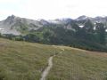
Side Trips to Hayden Pass, Sentinel Peak, & Thousand Acre Meadows
|
|
|
|
|
|
|
|
|
|
|
|
|
|
|
|
|
|
|
|
|
|
|
|
|
|
|
|
|
|
|
|
|
|
|
|
|
|
|
|
|
|
|
|
|
|
|
|
|
|
|
|
|
|
|
Backpacking from Dosy Meadows to Gray Wolf Fall camp site (Cedar Lake Junction):
|
|
|
|
|
|
|
|
|
|
|
|
|
|
|
|
|
|
|
|
|
|
|
|
|
|
|
|
|
|
|
|
|
|
|
|
|
|
|
|
|
|
|
|
Day 4: Hike out from Cedar Lake Junction (Gray Wolf Fall) to Deer Park.
---- (Backpacking 9.5 miles with 3200 ft elev gain. Side trip:
4.4 miles with 1000 ft elev.)
***
Trails: Gray Wolf river Trail - Three Forks Trail. Gray Wolf trail had
no down tree. Ceder Lake trail had many down trees.
Technical specifications:
Side trip:
Cedar lake Junction (4200 ft
elev) 0
miles
To Cedar lake (Elev 5250 ft) & more 2.2
miles (Total)
To Cedar lake Junction 2.2
miles (4.4 miles)
(Side Trip: 4.4 miles with 1000 ft elev gain)
Backpacking:
Cedar lake Junction (4200 ft elev): 0.0
miles
to Camp Ellis (3100 ft elev): 2.7
miles (2.7 miles)
to 3 folk junction (2200 ft elev): 2.7
miles (5.4 miles)
to Deer Park (5400 ft elev): 4.1
miles (9.5 miles)
--- (Day 4: 9.5 miles with 3200 ft elev gain. Side
trip: 4.4 miles with 1000 ft elev.)
A view of the Cedar Lake from East.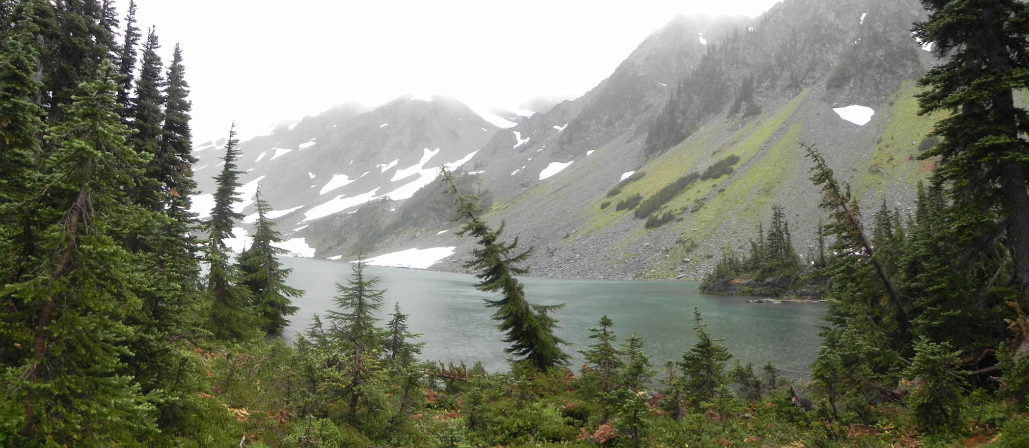
Slept about 4-5 hours at the Cedar Lake Junction (Shelter was burnt down). 10.5 hours (1930 - 0600) of resting in the test. A couple of good AM radio stations but did not have time to listen as my legs were sore. Started Strength 8 (1-10 good) and ended with 1. Started spirit 10 and ended with 10 (1-10 good). 9 hours of side trip and backpacking for the day.
I was half asleep early in the evening and half awake most of the morning as it rained. Rain appeared to be slowed down around 0600, so I got up in the dark and started packing everything except for the tent. I was determined to do a quick side trip to the Cedar Lake. On my mind, if I didn't do the Cedar Lake side trip, I would regret it since I probably would not come back this way for a long time. While I was on 15 minutes into the Cedar Lake side trip, it started raining again. Since the weather was not cold, it felt ok to be wet but actually I felt strong. The Cedar Lake trail was not steep (4200 ft to 5250 ft elev gain in 2.1 miles) in general but theer were some steep sections. The trail was not maintained and had some down trees. For a few times, massive scrambling, route finding, & fording a creek were necessary. When arriving at the Cedar Lake, yes, it was a worthy trip. The alpine lake was truly beautiful, similar to the Lake of the Angels but with more grayish color and still melting humongous snow on the rims. And it was the place where I thought the Lake was on the previous day. I could have traveled from the Gray Wolf basin to the Lake. I could not see the way trail but could guess it. There was a few camp sites on the East side and, unsurprisingly, nobody was there. Quickly hiked down the trail with much cautions since the trail was wet and slippery. I got totally soaked from my pants to my boots. My boots got completely soaked and I could feel the water in the boots. It looked like water got in through my legs (*** I need to prevent this on my next backpacking trips. Soggy boots would not be pleasant if it happened on an earlier day of my trip.). Upon arriving at the camp site at 0930, crawled in the tent, squeezed the water out from the socks, and drained the water out of the boots (it was that bad). Had a pair of dry socks but it did not help much since the boots were completely soaked. Laid down for 20 minutes hoping for the rain to stop. It looked like raining would not stop and I needed to hike out (as I told my family I would be home about 1700). At 1020, I started hiking out to the Deer Park in the rain. I quickly arrived at the 3 Forks at 1220 (hiked 5.4 miles in 2 hours). Drizzling stopped by then, but continued to sprinkle here and there.
Now, the painful story of my physical condition (but no injury, not really bad). About 1/4 way up the Deer Park (4.1 miles with 3200 ft elev gain), I started feeling exhaustion. My legs were getting pains and I was breathing heavily. Luckily, the diarrhea I had on the previous day was gone (I had almost nothing in my stomach anyway). I did not eat anything for the dinner on the previous night. I ate a raw ramen in the morning (that is one reason that ramen is good for backpacking since it can be eaten uncooked or cooked). Also, I did not drink much water (may be just 1L) because it was cool & cold all day. I still had some dry food but did not have any appetite. It was a big struggle and challenge going up the 3 Forks trail. My biggest concern was a possible injury that might end my outdoor activities for a while. I had to pay close attention to any soreness or abnormality of the body. I advanced 800 ft elev in one hour, then started having short breath, fatigue, and painful legs. I took 3-6 steps at a time with heavy breathing on every step. Combination of slow steps and heavy breathing helped advanced slowly. Later about 1000 ft elev to go, I was in cruise mode: one step at a time with heavy breathing. I finally arrived at my car, Deer Park at 1620. It took me about 4 hours to hike up 4.1 miles with 3200 ft gain ! I will never forget that struggle. It was a similar experience of hitting a wall when I ran a marathon for the first time (& the last time) in 2002. I rested about 5 minutes in my car and started driving down the Deer Park. On the way down, when there was cellar phone signal, I talked to my daughter. A huge relief that everything was ok at home and I was on my way to end my trip. That was the end of my first multi-days solo-backpacking trip in Olympics. I felt really good driving home.
The highlights of the day was the side trip to Cedar lake and struggle for the hike out.
|
|
|
|
|
|
|
|
|
|
|
***** Grand Total (Backpacking: 37.9 miles with 10750 elev gain. Side Trips: 12.7 miles with 4000 ft gain).-----A total of 51 miles with 14,750 ft elev gain in 3.25 days
People sighting for the trip: None on the trail. On Fri, saw a tent at the Dosy Meadow and saw two backpackers in the distance heading to the Hayden Pass. On Sat, I heard people talking on the Hayden Pass. They also summited the Sentinel Peak. When I was on the Sentinel Peak, they went down to the North and back to Hayden Pass. My guess was that they were the same two people I saw in the distance on Fri afternoon when I arrived at Dosy Meadows. On Sat, I saw 6 backpackers at the Gray Wolf Fall just arrived from Deer Park.
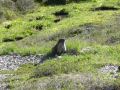
Animal sighting: No bear. Three Deer at Deer Park. Saw marmots and eagles (or hawks) a few times.
MY LESSONS LEARNED for multi-days BACKPACKING:
a. Need a lightweight rain
pant
b. Need a lightweight rain fly for the backpack
c. Need a lightweight
gaiter to keep the feet dry
d. Carry an energy bar and hydrate with electrolyte
Surprisingly, my body and legs werer all right next morning. My legs were stiff and sore a bit, but I could hike again if I needed to .....
Well, if the weather looks decent again for a few days in the weekend, I want to go back out again, this time to the SW of the Olympics (Oneil Pass, Marmot/Heart/La Crosse Lakes, La Crosse Pass, Anderson Pass Loop via Enchanted Valley, 60 miles with 10,100 ft elev gain in 4 days following Mike Woodmanee's book).
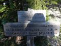
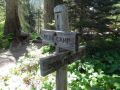
Deer Park trailhead (for Obstruction Pt (Grand Ridge), Deer Ridge, &
Three Forks trails) direction:
After passing the town of Sequim toward Port
Angeles to the West on HWY 101, turn left at Deer Park road (the road sign can
be missed easily because it is very small and on the turn. Big hint: Honda
& Toyota Car Dealers are at the turn). The first 8 miles are paved and the
next 16 miles are dirt road (progressively steeper and narrower).