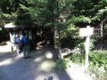
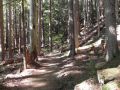
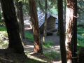
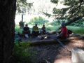
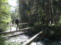
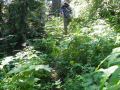
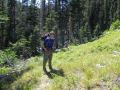
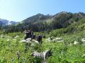
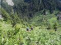
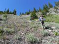
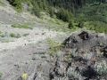
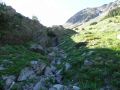
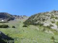
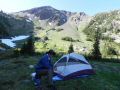
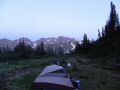
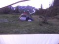
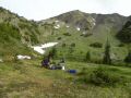
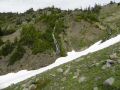
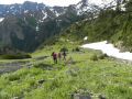
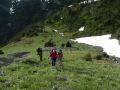
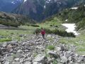
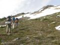
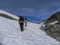
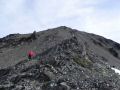
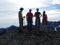
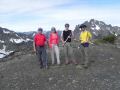
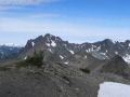
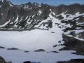
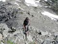
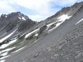
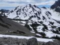
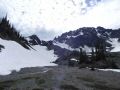
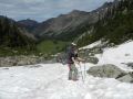
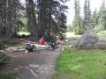
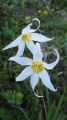
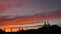
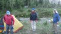
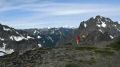
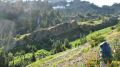
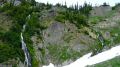
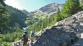
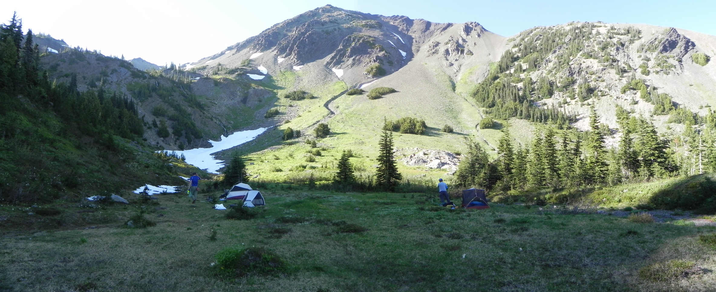
Ready to take off at the Upper Dungeness Trailhead Our camp site, Mt Fricaba in the background.

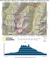
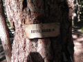
Heather Creek, Mt Fribaca, Hal Foss Peak, Deception Basin, Deception Pass, & Royal Basins Loop (20-21 Aug 2011) --- Estimated 17 miles with 5400 ft elev gain.
A 5-star rating and a tremendous backpacking trip in Olympics, but be aware of the vicious skeeters !
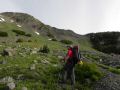
As I am getting to know more about the Olympics, the subject backpacking trip was interesting one, specifically, getting to the Deception Basin via Heather Creek. Typically, the Deception Basin was accessed via the Royal Basin (that I day-hiked last year), then the hiker could reach the Hal Foss Peak (7179 ft), Mt Fribaca (7139 ft), and Mt Mystery (7631 ft, other than from Dosewallips). I imagined that the Royal basin route (6000-6500 ft elev) would take 1-2 more days to summit those mountains. For the strong and experienced hikers, an overnigher through the Heather Creek would be an excellent choice to summit those 3 peaks, down to Deception Basin, up the Deception Pass, down to Royal Basin, and out in a loop (about 1/3 of the loop is off trails).
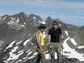
The trip was a PWC event sponsored by Doug Savage. He climbed Mt Fribaca
for a couple of times via the Royal Basin in about 20 years of hiking/backpacking
the Olympics, and this trip was the 2nd time via Heather Creek as he and Jay
Thompson (PWC member) successfully did the loop last year. Much appreciation
to Doug for allowing his time and taking us (Barbra, Paul, and I) there. This
trip was not certainly for a beginner (needs to have strength and not afraid
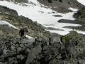
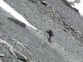
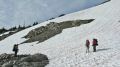
of height) as one needed to bush wack, scramble on
frail rocks/tree branches, hike on steep shattered shale and boulders, travel
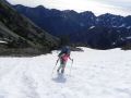
on snow, know how to use an ixe axe, and be moderately exposed. Traction
devices (micro spikes and crampons) were prepared but were not used. Strongly
recommend to travel with an experienced hiker (who already did the loop).
Ready
to take off at the Upper Dungeness Trailhead Our
camp site, Mt Fricaba in the background.
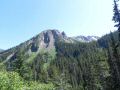
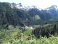
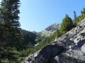
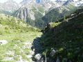
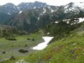
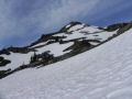
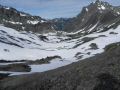
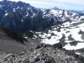
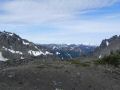
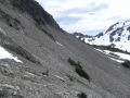
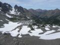
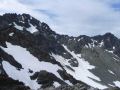
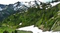
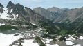
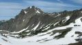
A
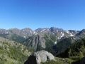
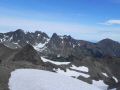
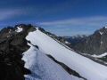
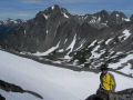
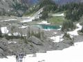
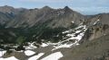
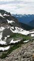
stunning view of the Deception Basin from the saddle between Mt Fricaba and Hal Foss
Peak (Mt Deception (7788 ft), the 2nd tallest in Olympics in the background.)
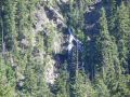
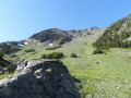
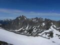
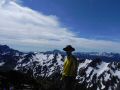
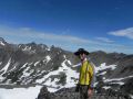
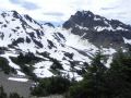
The
Mt Olympus (7989 ft),the tallest in Olympics in the distance)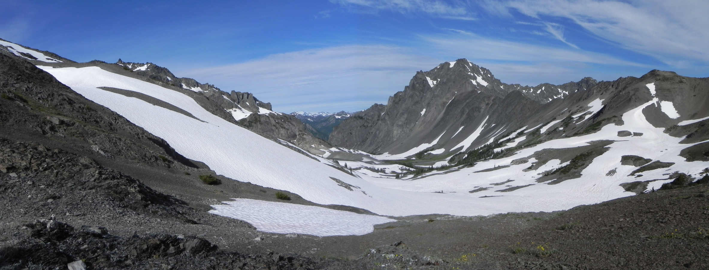
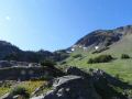
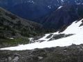
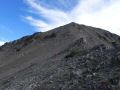
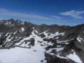
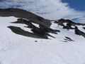
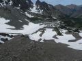
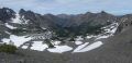
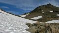
A
closer view of the Deception Basin (Mt Mistery on the left and Mt Deception
on the right)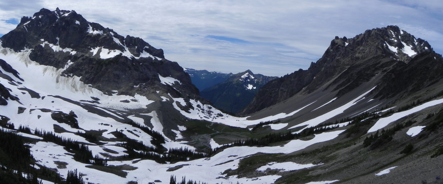
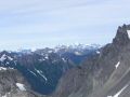
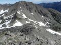
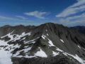
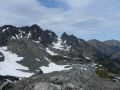
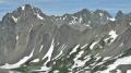
A
marvelous view of the Royal Basin from the Deception Pass (the Needles on the left, Mt
Baldy in the middle)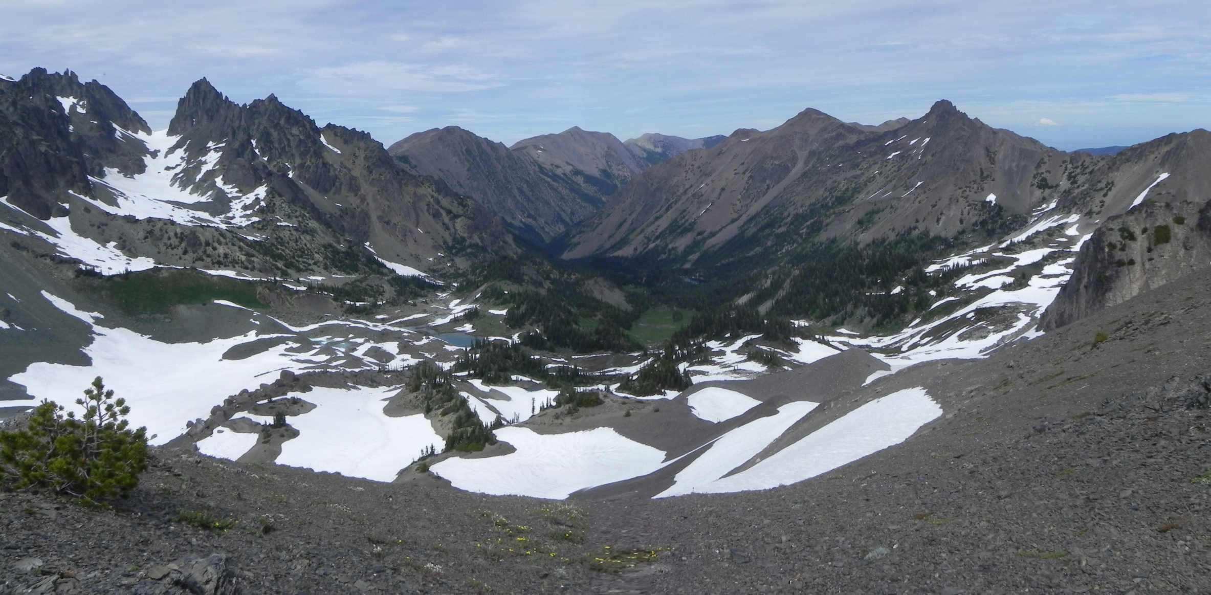
Three important notes to make this loop successful as an overnighter:
1.
Need to know the off-trail route from the end of the Heather Creek trail to
the saddle between Hal Foss Peak and Mt Fribaca.
2. Three places to
camp on the way up to the saddle (Mt Fricaba & Hal Foss Peak). My
preference is the 2nd one or near the saddle to make an easier 2nd day. The
strong hikers could set up the camp site below the saddle and summit the Mt
Fricaba on the first day. And summit the Hal Foss and Mt Mystery next
day. Not really sure if the Mt Mystery could be summited within reasonable
time (less than 1 hr). Hal Foss Peak was summited in 15 minutes from the
saddle between Mt Fricaba and Hal Foss.
3. Need to know the off-trail route
from Deception Basin to the Saddle (Deception Pass) above the Royal Basin. One
has to drop down to the Deception Basin and climb up the steep screed slop via
the boot track to the 3rd saddle looking up to the Mt Deception (right of the
sharp V saddle).
For the overall mileages, I estimated that the loop was about 17-18 miles with 4700-5000 ft elev gain. A day-hike will be possible but will be a tough one. However, it will be a fun and rewarding day-hike for the strong hikers.
Backpacking Summary:
Day 1 (left the trailhead 0940. Arrived
at the campsite 1630. About 8.2 miles with 3600 ft elev gain):
1.
0 miles (2500 ft elev). Upper Dungeness Trailhead (Royal Basin TH).
2. 1
mile (2800 ft elev). Junction to Royal Basin (go straight) and Heather
Creek (turn left over the log bridge).
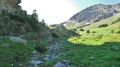
3. 3.4 miles (2700 ft elev). Camp
Handy. I did not walk down but should check the camp sites and shelter
as the trail rejoined at the camp site.
4. 3.7 miles. Junction to Marmot
Pass.
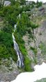
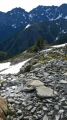
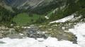
5. 7.2 miles (4200 ft elev). End of Heather Creek trail. Crossed
a log bridge 3 times total. It goes up to about 4300 ft and drop down to a samll
flat spot next to a stream. Need to go up via an avalanche chute where
the hiker will be exposed and slowly hike up like a mountain goat (one step
at a time).
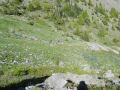
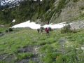
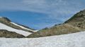
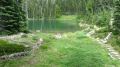
6. 8.2 miles (5500 ft elev). Camp site below the saddle
between Mt Fricaba and Hal Foss Peak. It was the first flat area (alpine
meadow). There was a small lake hidden in the trees and a couple of ponds (mosquito
breeding pool). The skeeters were bad but were not terrible. Got
more than a dozen bites.
Day 2 (Summited Mt Fricaba and Hal Foss Peak, down to Deception
Basin, up to Deception Pass, down to Royal Basin, and out to TH). About 9.5
miles with 1800 ft elev gain.
1. 8.2 miles (5500 ft elev). Left
camp site at 0820.
2. 8.7 miles (6500 ft Elev). Saddle between Mt Fricaba
and Hal Foss Peak. Dropped the packs at the saddle and climbed Mt Fricaba (30
min climb). Then, the Hal Foss (15 min climb). Both peaks offered
the magnificant views of the interior of the Olympics.
3. 9.2 miles. Deception
Basin (6000-6200 ft Elev).
4. 9.6 miles. Deception Pass (6800 Elev).
Left 1430. At the Pass, the views to both the Deception
(South) and Royal (North) Basins were simply amazing.
5. 17 miles. Down
to upper Royal Basin (6400 ft elev) and hiked out. Arrived at the Trailhead
(2500 ft elev) at 1900.
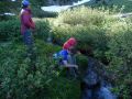
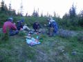
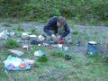
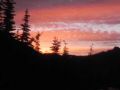
In overall, it was an excellent overnigher to look at some remote and interiors of the Olympics, and to summit a couple of prominent peaks in the Olympics. The worst thing about the trip was the mountain mosquitos (at higher than 3000 ft elev). They were pretty bad as I got bitten more than a dozen times but could be a lot worse. I had a mosquito spray and deet juice but I will need to take some additional measures (like a face net) against the vicious skeeters in the future trips. And always thanks to the trip sponsor (Doug) and the fellow PWC backpackers (Barbra & Paul) for a fantastic backpacking, a safe return, & positive energy.
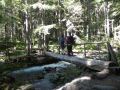
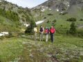
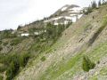
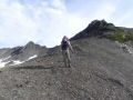
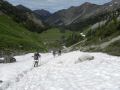
Picture story:
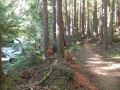
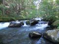
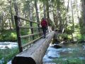
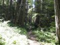
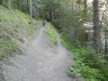
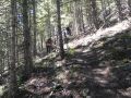
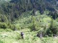
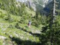
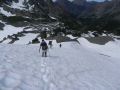
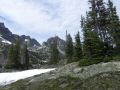
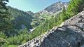
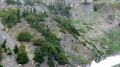
1. From Upper Dungeness TH to End of Heather
Creek Trail
|
|
|
|
|
|
|
|
|
|
|
|
|
|
|
|
|
|
|
|
|
|
|
|
|
|
|
|
|
|
|
|
|
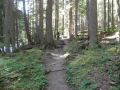
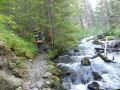
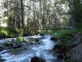
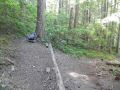
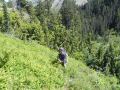
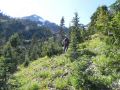
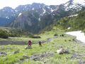
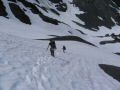
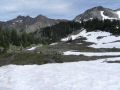
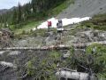
2. From End of Heather Creek trail to our camp site
|
|
|
|
|
|
|
|
|
|
|
|
|
|
|
|
|
|
|
|
|
|
|
|
|
|
|
|
|
|
|
|
|
|
|
|
|
|
|
|
|
|
|
|
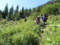
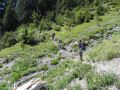
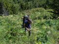
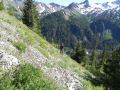
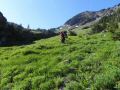
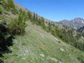
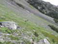
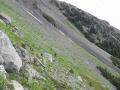
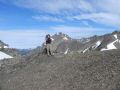
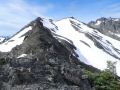
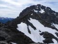
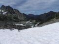
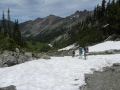
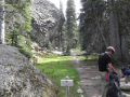
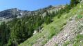
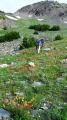
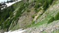
3. From Camp site to the saddle between Mt Fricaba & Hal Foss Peak, and to the Mt Deception Pass (Above Royal Basin)
|
|
|
|
|
|
|
|
|
|
|
|
|
|
|
|
|
|
|
|
|
|
|
|
|
|
|
|
|
|
|
|
|
|
|
|
|
|
|
|
|
|
|
|
|
|
|
|
|
|
|
|
|
|
|
|
|
|
|
|
|
|
|
|
|
|
|
|
|
|
|
|
|
|
|
|
|
|
|
|
|
|
|
|
|
|
|
|
5. From Mt Deception Pass to Upper Dungeness TH
|
|
|
|
|
|
|
|
|
|
|
|
|
|
|
|
|
|
|
|
|
|
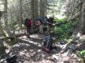
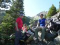
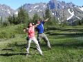
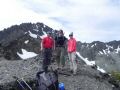
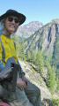
Here are some pictures of me and others from Paul:
|
|
|
|
|
|
|
|
|
|
|
|
|
|
|
|
|
|
|
|
|
|
|
|
|
|
|
|
|
|
|
|
|
|
|
|
|
|
|
|
|
|
|
|
Trailhead direction:
Upper Dungeness Trailhead (TH), the same as the Royal
Basin TH. 4 miles from here is the Tubal Cain Mine Trailhead.
a.
Follow Highway 101 to Sequim Bay State Park, turn west across from the state
park onto Louella Road.
b. Follow Louella Road one mile to Palo Alto Road
and take a left on Palo Alto Road for 1.1 mile to the Forest Boundary.
c.
The Palo Alto becomes FS Road #28. Turn right onto FS Road #2880, drive past
Dungeness Forks Campground for 1 mile stay left onto FS Road #2870 for 8.7 miles
to trailhead.