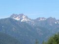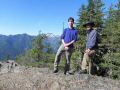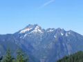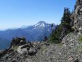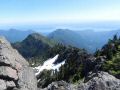
At the Mt Jupiter Summit: Brothers MT on the left and Mt Constance on the right.
A weekend for Hike, Bike, & Hike (Mt Jupiter & Mildred Lakes) (27-28 August) --- About 22.6 miles with 6300 ft elev gain in 2 days.
The weather has been very nice for the last few weeks. For the last weekend, I was not sure what I wanted to do since I did not want to do too strenuous hiking because I would be backpacking for the 4 days of the Devil's Dome Loop (North Cascades National Park) with the Peninsula Wilderness Club (PWC) members on the upcoming Labor day weekend. There were a few choices for the weekend: a PWC member was hosting a day hike to Mt Townsend (hiked before), Hood Canal kayak paddling (not paddled there before) on Saturday, and day hike to Wagonwheel (not hiked before) on Sunday. I could kayak and hike but, since both days would be nice, I decided to hike (fun), bike (fun), and hike (fun) but wanted to do moderate hikes.
I wanted to hike some trails where I had not hiked before and wanted to come home early Sunday afternoon so that I would have some time with my daughter for her driving practice (manual transmission). Talking with my friend, Aaron, we decided to day hike Mt Jupiter (14.4 miles with 3600 ft elev gain) on Saturday and the Mildred Lakes (8.2 miles with 2700 ft elev gain) on Sunday in the Olympics. Both of us have not hiked either trails before. We also decided to car camp near the trailhead on the Saturday night, so that we could save some time and come home early on Sunday.
I wanted to make sure my wife was ok with what I wanted do. She has been in a good spirit recently as I spent my time to take care of our son (dropping him off at the WSU), and has been spending the week days at home and with our daughter for her driving practice. I got home little late around 1830 but it was early enough for a good dinner and taking my daughter for driving practice. So, it turned out to be a very nice weekend and looking forward to 4 days of backpacking on the coming weekend.
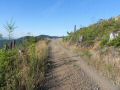
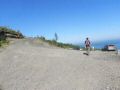
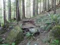
Access road condition to both Mt Jupiter and Mildred Lakes (Recommend to
use a high clearance vehicle):
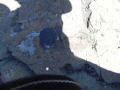
My car got bangged up pretty bad on the bottom.
READ BELOW at the trailhead direction section.
Here was day hikes summary:
Day 1 (Saturday, 27 August).
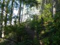
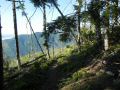
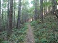
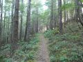
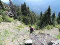
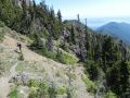
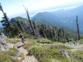
Mt Jupiter hike. A blue bird day with temp 50-80s. A few skeeters
but was not that bad. NO WATER REFILL SITE. Carry enough water for the entire
hike (3L-4L). Met 2 dayhiking parties (2 & 3) on the way down. It
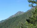
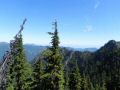
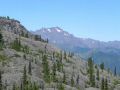
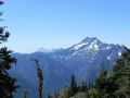
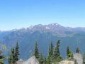
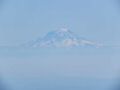
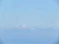
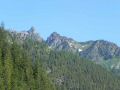
was about 14.4 miles roundtrip with 3600 ft elev gain. Mt Jupiter (5701
ft, in the Brothers Wilderness) is one of the prominent peaks in the eastern
Olympics, which could be seen from the Seattle area on a clear day. The
other prominent peaks in the eastern edge of the Olympics are Mt Washington,
Mt Constance, & The Brothers Mt. So, I was eager to add this trail
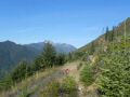
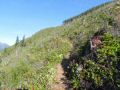
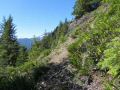
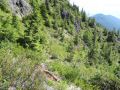
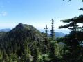
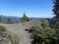
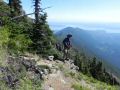
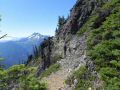
to my hiked list. As Seabury Blair mentioned in his book (p44, Jupiter
Ridge), the trail is pleasant stretch of the legs with spectacular ridgeline
views as it stretches upward and westward. The last 1 mile or so was steep.
The author talked about the Jupiter Ridge trail and recommended the hike for
the strong hikers. There is also moderate height exposure.
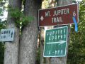
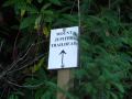
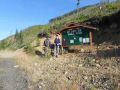
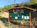
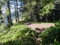
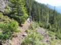
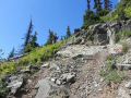
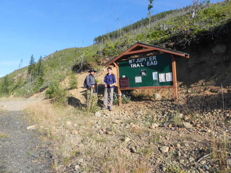
Ready
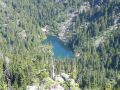
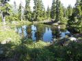
to hike at the Mt Jupiter Trailhead Jupiter
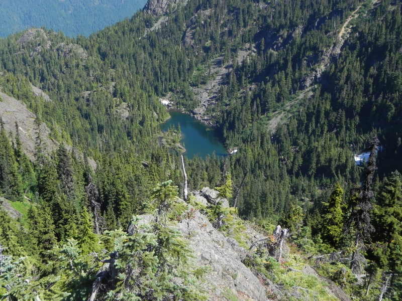
Lake (did not go down 900 ft elev via bush wack ). At
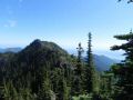
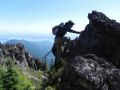
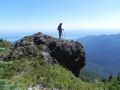
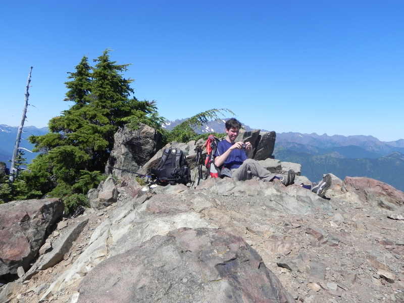
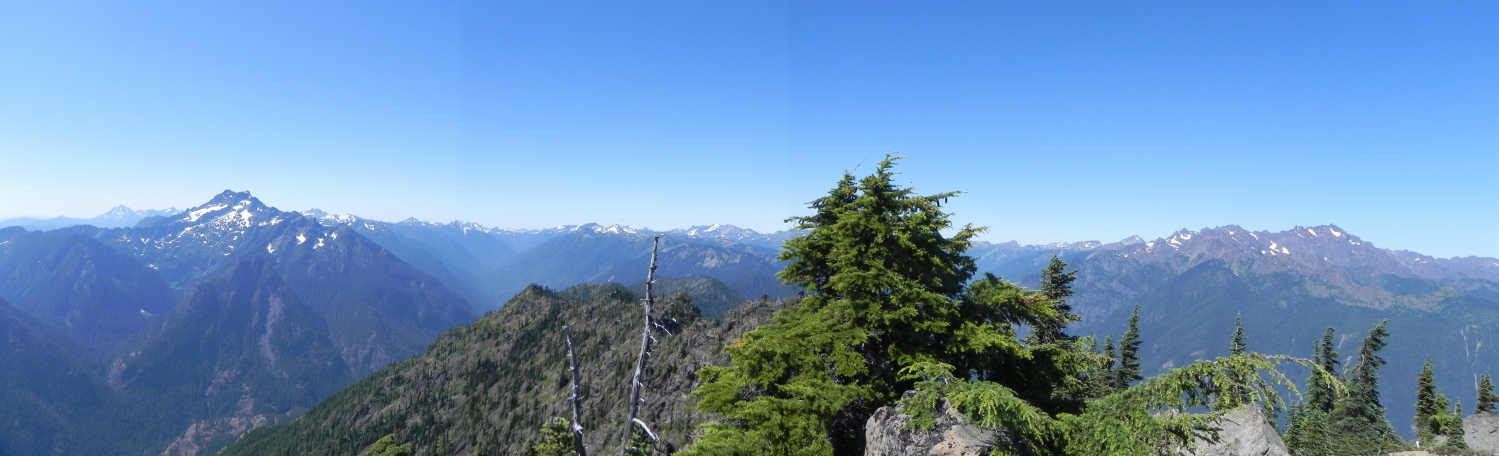
the Mt Jupiter summit
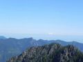
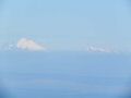
At
the Mt Jupiter Summit: Brothers MT on the left and Mt Constance on the right.
Hiking Highlights (NO WATER REFILL SITE, always carry enough water):
a.
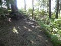
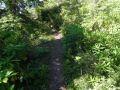
Trailhead (2000 ft elev)
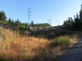
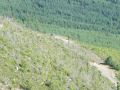
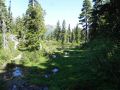
b. 1 miles (2600 ft elev). clear cut treeline.
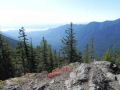
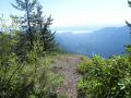
c.
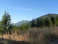
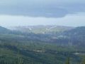
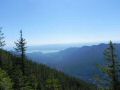
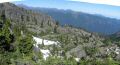
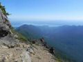
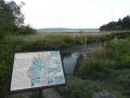
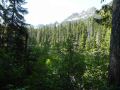
3.6 miles (3900 ft elev). To a look out site (Duckabush Delta and Valley).
A view of The brothers MT. It is about Half way point.
d. 5.7
miles. The Brothers Wilderness (3950 ft elev). This mileage from the fs.fed.us
website could be wrong. It looks like 4.5- 5 miles at this point.
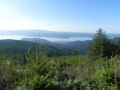
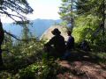
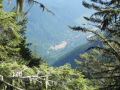
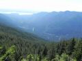
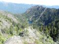
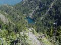
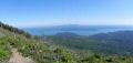
e.
6.5 miles (estimated, 5400 ft elev). A view of the Jupiter Lake (4500 ft) below
toward the Dosewallips valley.
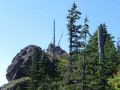
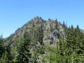
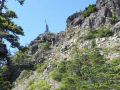
f. 7.2 miles. To the Mt Jupiter
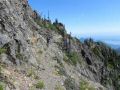
Summit (5701 ft). It was steep and some exposed areas. Along the
trail, Mt Jupiter were seen that looked like a vertical wall. A hiker
may wonder if there is a trail going up there. As the hiker continues
going up the ridge, the steep switchback trail is there. The summit
has a reasonable flat spot that can accommodate about a dozen of hikers and a
small flat spot (good for one tent camping spot) about 20 ft before the summit.
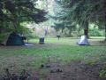
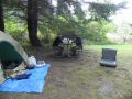
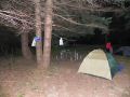
For overnight camping, we drove around. We stopped by at the Collins Campground (National Forest) on the Duckabush Road. Then, we drove to the Dosewallips State Park Campground. The campground was full, except for a RV site ($31). The park ranger let us camp at a overflow campsite right ($14) for bikers/hikers next to the parking area close to the beach access area and right next to the HWY 101. It was an awful choice. Oh well, we learned the lesson all right. Fell sleep about 2100 till 0040, then half awoke till 0600. We just could camp along the Hamma Hamma road next to a creek for free. As we drove next day on the Hamma Hamma road, there were a few campers along the road.
|
|
|
|
|
|
|
|
|
|
|
|
|
|
|
|
|
|
|
|
|
|
|
|
|
|
|
|
|
|
|
|
|
|
|
|
|
|
|
|
|
|
|
|
|
|
|
|
|
|
|
|
|
|
|
|
|
|
|
|
|
|
|
|
|
|
|
|
|
|
|
|
|
|
|
|
|
|
|
|
|
|
|
|
|
|
|
|
|
|
|
|
|
|
|
|
|
|
|
Day 2 (Sunday, 28 August). Mildred Lakes hike. A blue bird day with temp 50-80s. Got bitten a few places by the skeeters. A few at the Lake but was not horrible. On the way up, met 3 backpacking parties (5, 2, &2) coming down. And 1 dayhiking party (3). It was about 8.2 miles with 2700 ft elev gain. Along the Hamma Hamma Road, it has trailhead for Lower/Upper Lena Lakes (to The Brothers MT), Lake of the Angeles (to the MT Stone), and Mildred Lakes at the end of the road. I have hiked all except, the Mt Stone and the Mildred Lakes.
So, I was eager to hike this trail like the Mt Jupiter. Definitely,
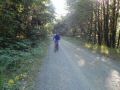
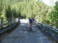
needs a high clearance vehicle. We biked about 3 miles to the Mildred
Lakes trailhead. Aaron had a muscle cramp on Saturday and wanted to take
a caution, so he decided to not to hike this trail. He biked back to the
car.
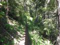
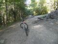
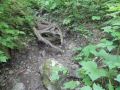
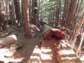
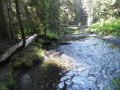
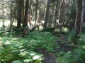
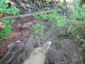
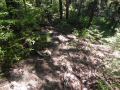
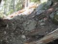
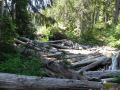
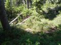
Biked about 3 miles to the Mildred Lakes Trailhead. Rugged
trail 10
ft drop in the ravine (needs to scramble on the way up).
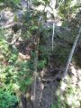
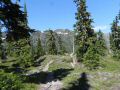
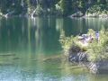
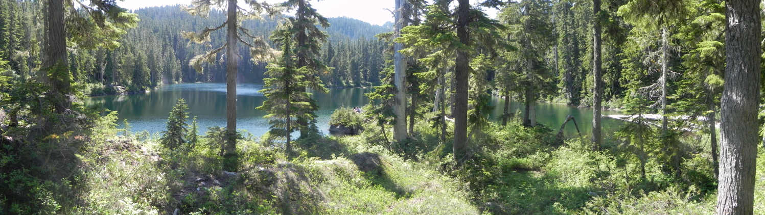
A
sub-Alpine Lake hidden in the forest. The Saw Tooth Ridge in the
background. Beyond the Saw Tooth is the Flapjack Lakes.
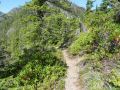
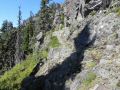
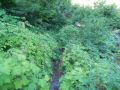
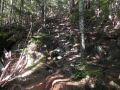
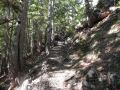
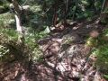
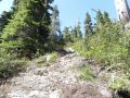
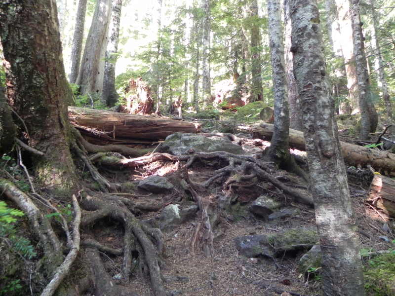
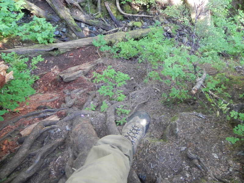
Hiking Highlights (Rugged trail with rocks and tree roots, and fairly steep
with ups-and-downs):
a. Biked in about 3 miles. 1 miles before the
Lake of the Angels and 2 miles beyond to the end of the road (Mildred Lakes
trailhead). When hiking was done, it was a BLAST of 15 minute bike ride
on a down slop.
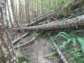
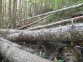
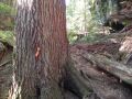
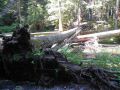
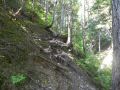
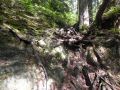
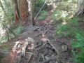
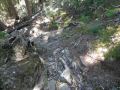
b. The hiking trail was a lot tougher (rugged and
steep) than I imagined. Think of the trail as "a miniature version
of an obstacle course." I think the Mildred Lakes trail (1800 ft
elev) was the most rugged short trail I have ever hiked so far. Most of the
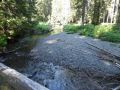
trail was full of rough stones and masses of tree roots. From the trailhead
(1800 ft elev), need to hike up to 3300 ft elev and drop down to the creek (3100
ft elev). No doubt that there was some steep sections with root &
rock staircase.
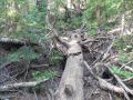
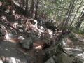
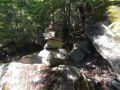
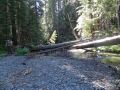
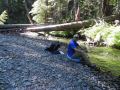
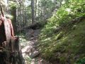
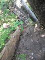
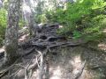
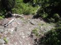
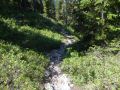
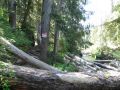
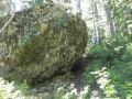
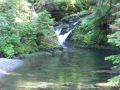
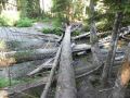
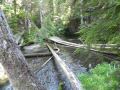
c. After crossing the Huckleberry creek (3100 ft elev) on
the fallen tree bridge, the trail got steeper to the top (3900 ft elev).
It was about 1700 ft gain in 1 mile miles. As Robert Wood (Olympic
Mountains Trail guide) mentioned, it had interesting "Rock staircase."
It was quite easy to go up but could be dicey when coming down. If
wet, a hiker should not attempt to hike this trail. My pictures do not
illustrate well but it was pretty rocky, rooty, & steep. There
was no height exposure since the trail was in the tree canopy, but one can hurt
badly if lost a step and fell. Constant attention and good concentration
to the trail are required.
Route founding:
The fs.fed.us website mentioned this about the Mildred Lakes trail:
"This
way trail is no more than a path established by hikers and fishermen over the
years. It is not maintained. The elevation gain on this trail is deceiving as
it climbs up steeply, then down, then up again and then down to the lakes. It
is well established to Huckleberry Creek, but beyond this point it becomes steep
and difficult to follow. Because of the primitive characteristics of this trail,
it is strongly recommended that boots with lug soles and high tops be worn when
hiking this trail."
Here are my tips for the routes:
Two backpackers said that they got lost
for about 3-4 hours in the beginning. Another pair of backpackers said
that they had hard time finding the Lake just above the Lake at the rocky area.
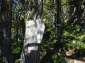
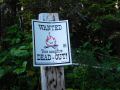
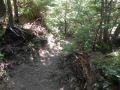
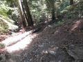
1.
Trailhead to the Huckleberry Creek: Follow the sawed off trees along the
trail. There are a lot of sawed off trees along the trail.
2. At the
highest point of the hike, turn left, continue along the ridge, and hike
down to the lakes. About 100-150 ft drop ! By going straight, a
short side trip could be taken to have a view of the Mt Stone & St Peter's
Gate right side of the Lake of the Angeles.
3. Near the Mildred Lake, the
final route for finding the Lake could be confusing without a map because the
trail turns to a way trail (not distinct trail). At the T, one will
hear a rumbling waterfall noise from the right. After dropping down to
a shallow ravine, turn left (a broken tree) just before the T. Also, the
Sawtooth ridge can be seen on the left and used as a benchmark since the Lake
is located toward the Sawtooth ridge. CAUTION: There is solid trail to
the right with the cairn marking but don't go there. As the map indicates,
turn left (trail is fainted or gone). A small lake appears (at this point,
the Mildred Lake is not still visible as it is around the corner to the
right). The small lake is the lower portion of the Mildred Lakes. When
going around to the left, one will see the distinct trail along the edge of
the small lake. When comes to a log jam, one will see the MASSIVE
LAKE BY SURPRISE (an Expansive view of an sub-Alpine lake surrounded by trees).
That's where the picture of the Lake was taken on Robert Wood's book.
Trail continues to the left of the Lake but, need to cross the log jam
to the right and continue going around the Lake counterclockwise. There
is a resting and picture taking spot on the middle edge of the horseshoe shaped
lake. The trail is fainted but should be able to recognize the way trail
(go right of a boulder).
In summary, it was a good weekend of hike, bike, and hike. It was always fun and thrill to hike the trails for the first time. The Mildred Lakes trail will be one of my favorite short hikes along with Mt Washington scrambling hike. Again, the Mildred Lakes trail should to be hiked during the summer (dry season).
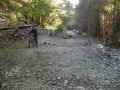
Biking from road washout to the Mildred Lakes Trailhead.
|
|
|
|
|
|
|
|
|
|
|
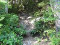
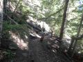
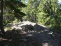
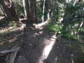
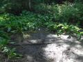
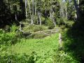
From Mildred Lakes Trailhead to the Huckleberry Creek.
|
|
|
|
|
|
|
|
|
|
|
|
|
|
|
|
|
|
|
|
|
|
|
|
|
|
|
|
|
|
|
|
|
From Huckleberry Creek to the Mildred Lakes, and back to trailhead:
|
|
|
|
|
|
|
|
|
|
|
|
|
|
|
|
|
|
|
|
|
|
|
|
|
|
|
|
|
|
|
|
|
|
|
|
|
|
|
|
|
|
|
|
Mt Jupiter Trailhead Direction:
Driving south from Quilcene on Hwy 101, about 2.5 miles south of Brinnon, turn right onto Mount Jupiter Road. It is a small sign so be alert (also right after the sharp turn coming from HWY 101 north). Follow the gravel road and signs to Mt Jupiter trail for about 6 miles.
Mildred Lakes Trailhead Direction:
On the Hamma Hamma Road, drive 14 miles to the end of the road. Pass
the Lena Lakes trailhead. And 2 miles more from the Lake of the Angeles
TH.
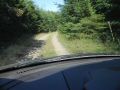
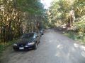
Access road condition (Recommend to use a high clearance vehicle):
a.
Mt Jupiter. My car was banged up pretty bad on the bottom on the access forest
road to Mt Jupiter trailhead. In overall, the access road was in excellent
condition but the over grown bushes in the middle section and some rocks were
constantly hitting the bottom of the car. My catalytic converter was bitten
up pretty bad. A little higher clearance vehicle would work fine.
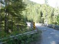
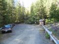
b.
Mildred Lakes. About 1-1.5 miles before the Lake of the Angels trailhead,
there were about 4 washouts. I made the first two but one of them scraped
the bottom bad. We parked the car and rode the bike from there.
It was about 1 mile to the Lake of the Angeles and 2 miles more to the
Mildred Lakes trailhead. After passing the Lake of the Angeles trailhead,
there was also a washout area but easy driving with a high clearance vehicle.