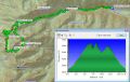
Hiking Charlia Lake (Beyond Marmot Pass), 17 miles with 6300 ft gain. Fri, 8-9-2013
This week's hike was my solitude for the year. This was my 4th consecutive Friday hike on my federal furlough or day-offs. The good news was that our furlough days got reduced from 11 to 6 days. So, I won't be hiking every Fridays any more. I would rather go back to work after seeing 20% cut on my paychecks !!!
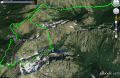
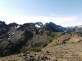
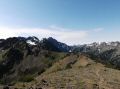
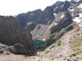
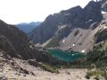
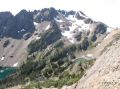
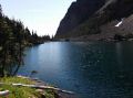
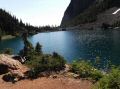
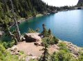
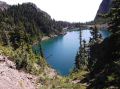
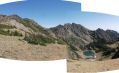
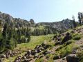
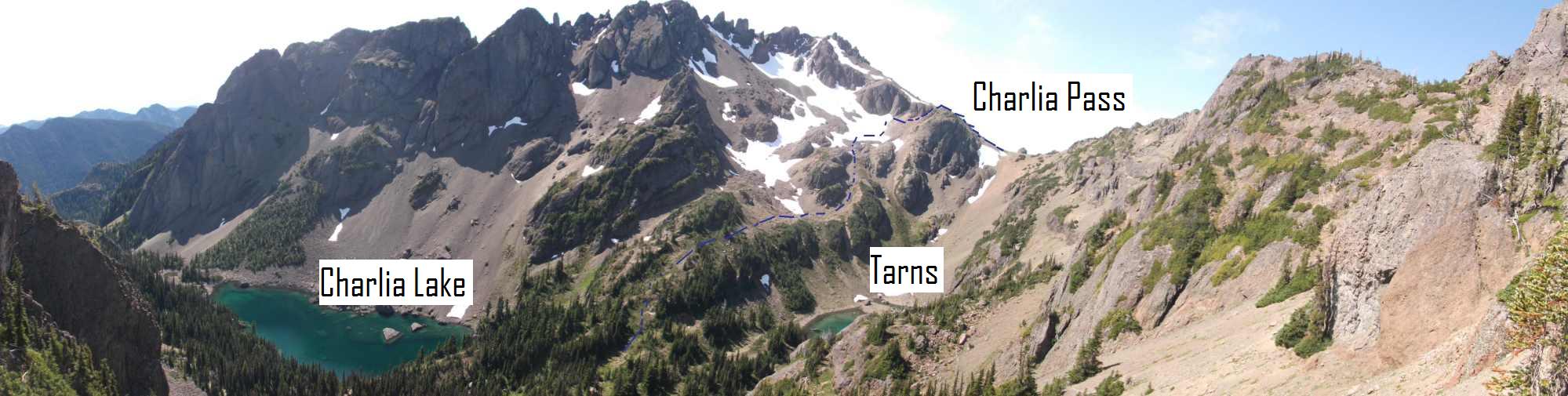
I have hiked Marmot Pass several times and Charlia Pass once via the maintained & semi-way trails. When I hiked the Charlia Pass, I wanted to connect between Charila Pass to Marmot Pass some day since it looked just over the ridge. On the NWhikers forum about 2 weeks ago, a couple traversed from Marmot Pass to the top of the Charlia Lake Ridge and took some pictures of the Lake. Looking at their pictures, when I hiked the Charlia Pass, I misunderstood the Lake as one of the tarns above the Lake. The Charlia Lake can not be seen from the Charlia Pass ! It can be only seen from the Ridge from the Marmot Pass.
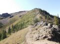
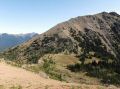
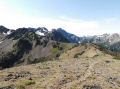
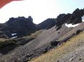
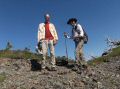
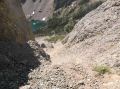
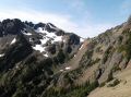
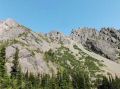
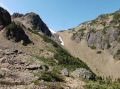
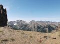
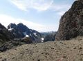
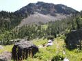
So, it was sort of my 4th consecutive adventurous hike (Petunia Peak, Gray Wolf Ridge, Cunningham Pass, & Charlia Lake). It turned out to be a class 2 hike between Marmot Pass and Charlia Pass. No scrambling was involved but traversed some steep slopes. It was straight forward that I walked along the South Ridge from the Marmot Pass, crossed over to the East (left) by dropping down about 100 ft-150 ft, traversed, and went up due to rugged ridge aiming for the "V" saddle that would have a view to the Charlia Lake and Pass. Then, I spotted a hiker going up the "V" saddle and whistled. He waved and moved on. I met him (David, an active member of the NWHiker's form) on the "V" saddle. He dropped his pack and went to West (toward the Charlia Pass) to take some pictures of the Lake. I talked to him for a while. He was a very experienced hiker who knew lots of way trails. He even talked about hiking the Petunia Peak along the Ridge starting from just pass the Junction of Royal Basin and Boulder Shelter which I have never thought about. From the "V" saddle, I took the steep scree slope down, hopped over the rocks, and bushwhacked to the Lake (a total of 1000 ft drop in elev.) Looking at me from above, David congrat me when I hit the rock slides. (I could try to go straight from the "V" saddle to the Charlia Pass but wanted to avoid any "scrambling" since I was a solo and do not mind down and ups of the steep scree slopes. )
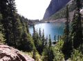
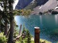
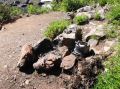
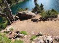
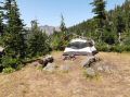
I saw just one camp site at the Lake. I wanted to walk around the Lake and to the southeast of the Lake, and see the Tunnel Creek Area (for Cunningham Pass) but did not see a path walking around the Lake. Somebody littered the only campsite with a kettle. Because of its tough access, the Lake was truly isolated and seldom visited by the hikers/backpackers. I saw a couple of big splashes on the Lake which are the sign of fish presence.
My tentative plan was to traverse back to the Marmot Pass if easier but I decided not to go back up 1000 ft to the V saddle. I felt good and I thought that it's more fun to make a loop by going up to the Charlia Pass (1000 ft up), down to the Boulder Shelter (1200 ft down), and back up to the Marmot Pass (1000 ft up).
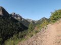
My routes were Upper Big Quilcene TH, Shelter Rock Camp site, Camp Mystery, Marmot Pass, Charliea Lake, Charlia Pass, Boulder Shelter, Marmot Pass, and back to Upper Big Quilcene TH. Surprisingly, it was a 17 miler with 6300 ft elev gain.
Trail and Route Description (hiking hours were
0730-1630):
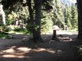
a. Upper Big Quilcene TH (2500 ft elev) to Shelter Rock
Camp Site (3650 ft elev): 2.6 miles. Camp
site was empty.
b. Shelter Rock Camp Site to Camp Mystery (5400 ft elev): 2 miles.
4.6 miles total. Met one couple hiking out. A couple with 2 dogs at Camp Mystery.
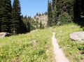
c. Camp Mystery to Marmot Pass
(6000 ft elev). 0.7miles. 5.3miles total. Took lots
of pictures of the wild flowers. Two tents with 4 people at the basin
just below Marmot Pass.
d. Marmot Pass to "V" saddle (6551 ft elev)
above the Charlia
Lake. 1.4 miles. 6.7 miles total. Met
David at the "V". Talked for a
while.
e. "V" Saddle to Charlia Lake (5510 ft elev). 0.5miles.
7.2 miles total.
f. Charlia Lake to Charlia Pass
(6340 ft elev). 1.1 miles. 8.3 miles total..
g. Charlia Pass to Boulder Shelter
(4920 ft elev). 1.6 miles. 9.8 miles
total. Two tents at Boulder Shelter area.
h. Boulder Shelter to Marmot Pass. 1.9
miles. 11.7 miles Total. Met two ladies from Olympia backpacking to Constance Pass. Gave away my mosquito spray.
i. Marmot Pass to
Big Quilcene Trailhead. 5.3 miles.
17 miles total. It was a hike
out on a highway. At
Marmot P, met 1 backpacker (talked for a
while) and 1 solo hiker. Camp
Mystery was getting full with the Boy Scouts.
4 more group of backpackers heading to Camp Mystery. Passed
4 day hikers who hiked the Marmot Pass.
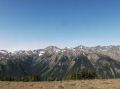
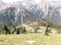
I guess the reasons I like the Olympics trails the most are its abundant creeks, rivers, and easy access to high country (typically above 4500 ft -5000 ft). I really like to hike those trails along the creeks and rivers (Dosey, Duckabush, Royal Creek, Heather Creek, etc). As I stroll along those trails, I feel like I am getting rejuvenated by tis negative ions (from streams, creeks, & rivers) and extra oxygen (from trees). Then, the high country above the tree lines provides the calm and peacefulness with its colorful settings (blue (sky), green (tree), white (snow), and gray (rusty rocks)).
It turned out to be a simple and joyful solitude hike for the week.
|
|
|
|
|
|
|
|
|
|
|
|
|
|
|
|
|
|
|
|
|
|
|
|
|
|
|
|
|
|
|
|
|
|
|
|
|
|
|
|
|
|
|
|
|
|
|
|
|
|
|
|
|
|
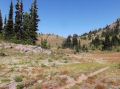
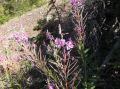
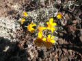
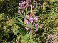
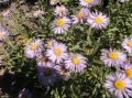
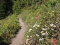
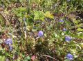
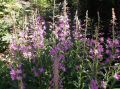
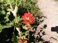
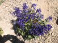
The flowers were withering but still in show on the
Big Quilcene Trail:
|
|
|
|
|
|
|
|
|
|
Direction for Big Quilcene Lower and Upper Trailhead for Mt Townsend hike:
From Quilcene drive, US 101 south for 1.5 miles.
Turn right onto Penny Creek Road.
After 1.5 miles, turn left onto Big Quilcene River Road (paved Forest Road 27).
Proceed on FS #27 another 10.6 miles to FS Road #2760 (follow 760 for 0.7 miles to the lower trailhead).
To the upper trailhead, stay one more mile on #2760 and turn left onto FR 27-190.
Drive 0.75 mile more to the end of the road.
Tunnel Creek to 5050 pass trailhead is also on the way up the Lower Big Quilcene Trailhead.