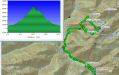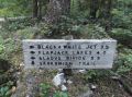
Hiking Black & White Lake (via Gladys Divide, Beyond Flapjack Lakes),Sun, 8-25-2013 .
It was about 21-22 miles with 4800 elev gain. Time spent was 0630-1600. For the weekend hike, I had time to hike on Sunday. I have been spending the Saturdays with my family. I wanted to put some training miles for the upcoming Bailey Range Traverse. The weather forecast did not look good, so decided to stay on a maintained trail. Since I've been hiking most of the trails in NE Olympics, I looked into the SE Olympics. The Gladys Divide sounded great. Gladys Divide is about 1.5 miles further than the Flapjack Lakes where I hiked once back in 2010. Hiking to the Flapjack Lakes was my 2nd consecutive weekend hike since I started hiking in July 2010. Its technical spec of 16 miles roundtrip with 3100 ft elev gain which was rated as "strenuous" and quite a long hike back then. However, now, I felt that it would be too easy with its elev gain of 3100 ft. Gladys Divide would give another 3 miles roundtrip with 1100 ft more elev gain. So, the total spec was about 19 miles with 4200 ft elev gain on the maintained trails. Planning for the trip, I googled Gladys Divide and read Jay Tompson (PWC webmaster)'s website about Gladys Divide and Ancient Ambler's report on NWHiker's forum about hiking from Gladys Divide to Black & White (BW) Lake on off-trail. In my opinion, AA has been providing one of best trip reports on off-trail adventures in NWhikers website. Its route would provide a 2 mile loop (Junction between BW Lake and Flapjack Lakes, Gladys Divide, BW Lake, Junction between BW Lake and Flapjack Lakes), and add about 2 more miles with 500 ft elev. So, the total technical specs would be about 21 miles with 4700 ft elev. My plan was hiking to Gladys Divide and back, and to BW Lake with a loop if weather is decent.
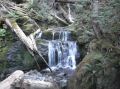
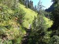
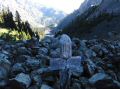
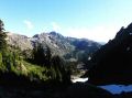
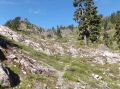
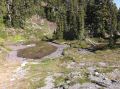
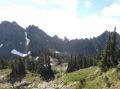
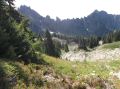
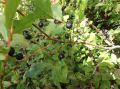
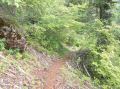
Fortunately, forecast of 30% chance of rain did not happen and turned out to be a decent weather (no raindrop but often sunny). I ended up hiking to BW Lake (off-trail via Gladys Divide) as described by AA and then almost to the Smith Lake (0.9 miles more from BW Lake) but turned around on the last 0.1 mile or so because its trail was dropping steep to the Lake. I did not want to hike solo but nobody signed up from PWC or Kitsap Hikers Facebook. So, it was my second solitude hike for the year. Only one thing that I was afraid of during the hike was a hungry or a mother bear because it is definitely a season for the full-blown huckleberries. There were lots of huckleberries near the Flapjack Lakes. The best huckleberries that I have seen so far were near the BW Lake (a lot better "huckleberries" than the High Divide Loop trail or the Brother Mt trail). I was constantly looking out for a bear but did not see any.
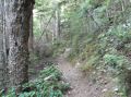
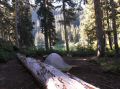
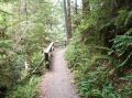
There were several backpackers along the trail to the Flapjack lakes. Right along the trail at elev near 3300-3400 ft, and just below the junction with BW Lake and Flapjack Lake (0.5 miles to Flapjack Lakes), there were two nice camp sites with camp fires and water source. One backpacker mentioned that there was a camp site just below the Madelyn Creek Bridge but I did not see it.
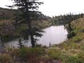
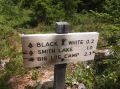
There were many backpackers at the Flapjack Lakes (I did not bother to walk around the Lakes but munched on lots of huckleberries) and no backpackers at the BW Lake. Trails to the Smith Lake had overgrown bushes and many surrounding tall trees despite its altitude of 4500 ft, The Smith Lake could not be seen from above. Not sure who would go to the Smith Lake. For an overnighter, I would prefer the BW Lake with its remote location and some views of the Olympics if went up to the ridge.
Here is a summary based on known miles and my GPS data for off-trails.
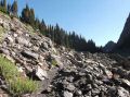
My GPS had some gaps that's an indication of poor
satellite signal reception and skipped some switch back trails. So, its actual miles are longer.
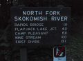
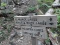
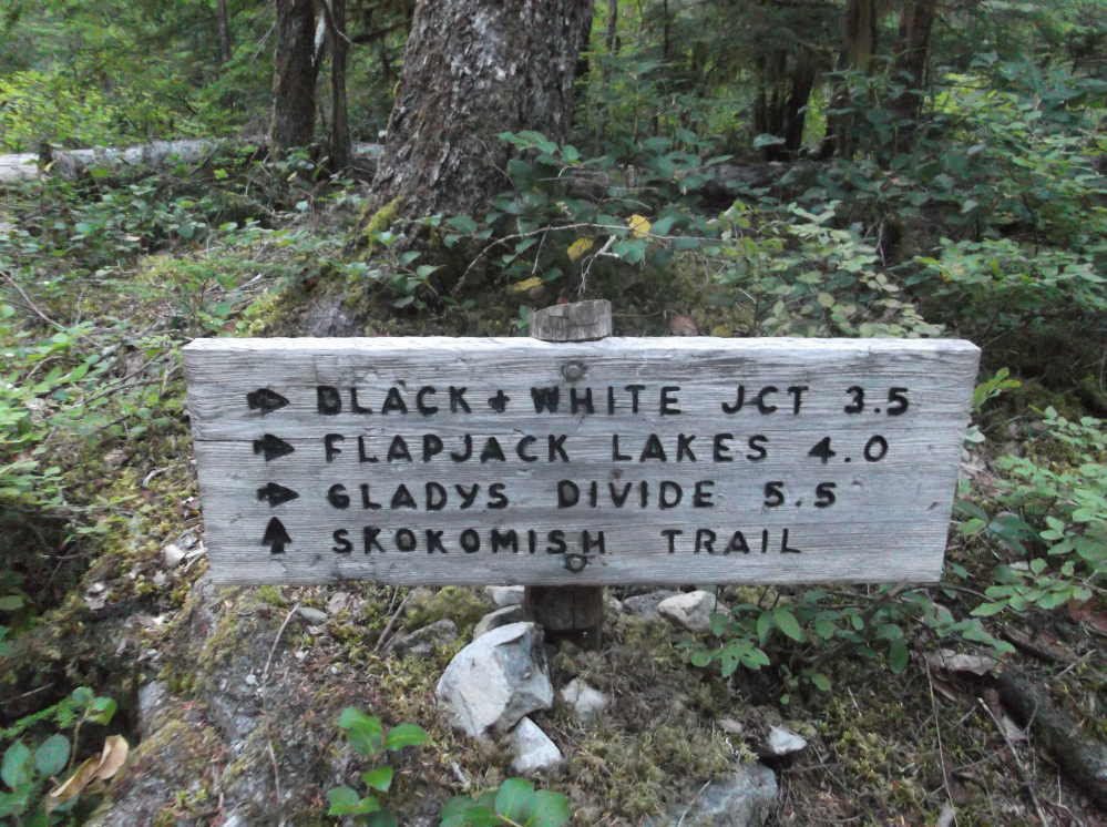
a. Staircase TH to Junction (Skokomish and
Flapjack): 3.2 miles.Maintained trail.
b. Junction to Black & White and Flapjack Lakes: 7.5
miles. Maintained trail.
c. To
Flapjack Lakes. 8 miles. Maintanined trail.
c. To Gladys Divide:
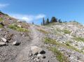
9.5 miles. It was considered as a
primitive trail but looked like a maintained trail..
d. To Mt Glady:
0.2 miles. Off trail. Lots of boot tracks.
Relatively steep 400 ft elev gain.
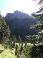
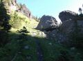
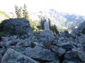
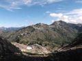
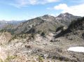
e. To Black & White Lakes loop: 2 miles.
Off trail. A couple of spots were exposed along the ridge (or traversing along
the ridge) and needed to scramble.
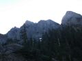
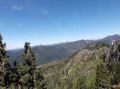
Views to the North were amazing.
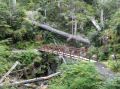
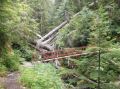
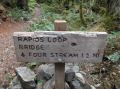
f. To Rapids Loop Trail (north side of the North Fork
Skokomish River) in Staircase.
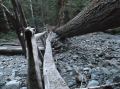
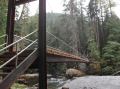
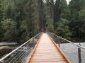
The new Rapids Bridge was the most impressive and massive one I've ever seen in Olympics.
g. Back to Staircase TH. 21 miles.
In overall, it was nice to be out and hiking at SE Olympics for the first time this year. I broke my own personal record for a long distance dayhike and felt great. My previous longest dayhike was the Constance Pass (19.6 miles with 3700 ft elev) roundtrip.
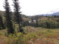
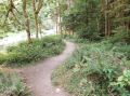
Another note: Hiked back to Staircase TH via the Rapids Loop (West side of the Skokomish River). An impressive bridge was rebuilt to do the Rapids Loop (2 miles with 100 ft elev) this year. It was a very nice trail and an excellent family hike along the Rapids (abundant source of negative ions). Highly recommend to check it out when in the area.
|
|
|
|
|
|
|
|
|
|
|
|
|
|
|
|
|
|
|
|
|
|
|
|
|
|
|
|
|
|
|
|
|
|
|
|
|
|
|
|
|
|
|
|
|
|
|
|
|
|
|
|
|
|