Climbing Mt Shasta (14179 ft) in Northern California (2-5 June 2013) - About 11 miles roundtrip with 7200 ft elev gain.
Climbed another volcanic mountain over 10,000 ft elev !!! Mt Shasta is the 2nd tallest Mountain in the Cascade Range (in the Western United States), and is the fifth highest in California (Mt Whitney (14505 ft), Mt Williamson (14379 ft), White Mountain Peak (14252 ft), North Palisade (14248 ft), Mt Shasta (14179 ft)). Mt Rainier in Washington State is 232 feet higher at 14411 ft. This was my 5th mountain among 11 "volcanic" mountains/peaks over 10,000 ft in the Western Continental United States (Climbed Mt Hood, Mt Adams, Mt Baker, Glacier Peak, & Mt Shasta). Another 3 peaks (3 Sisters) were scheduled to climb in 2 weeks. Due to conflict with my family schedule, I won't be able to climb the Three Sisters.
Mt Shasta trip was organized by a PWC (Peninsular Wilderness Club) member, Tom Henning, and joined by 8 other PWC members and friends. One group of 3 climbers participated with their own schedule. For the PWC, it was a re-visit in 8 year since the previous trip was in 2005.
Information about "Volcanic" mountains in the
Cascade Range and the top ten highest mountains in the Washington State:
a. The eleven "volcanic" mountains or peaks
over 10000 ft elev in the Cascade Range are :
Mt Rainier (14411 ft),
Mt Baker (10781 ft), Glacier Peak (10541 ft), & Mt Adams (12281
ft) in Washington State, Mt Hood (11249
ft), Mt Jefferson (10497 ft), &
Three Sisters (South 10,358 ft, Middle 10,047 ft, North 10,085 ft) in Oregon
State, Mt Shasta (14179 ft) & Lassen Peak (10462 ft) in California State.
b. The top ten highest mountains in WA are Mt Rainier (14411 ft), Mt Adams (12277), Mt Baker (10778 ft), Glacier Peak (10541 ft), Bonanza Peak (9511 ft), Mt Stuart (9415 ft), Mt Fernow (9249 ft), Goode Mountain (9200 ft), Mt Shuksan (9127 ft), & Buckner Mountain (9114 ft).
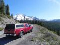
On this year's climbing trip, we were also planning to climb Lassen Peak (which is 50 miles southeast of Mt Shasta) but its trail was closed due to its trail maintenance. Upon completion of its trail, it will be 5 miles roundtrip with 1957 ft elev gain. Mt Shasta was 11 miles roundtrip with 7300 ft elev gian which is a typical technical spec for climbing a 10,000 ft high mountain. So, Lassen Peak is not much of a challenge compared to the rest of the 10 "volcanic" mountains over 10,000 ft elev. On this climb (about 11 miles round trip with 7300 ft elev gain), we climbed on the Avalanche Gulch route which has been known to be the easiest and most popular route to climb Mt Shasta.
Here is a short trip description:
Day 1: Drove 10
hours to Shasta City (about 550 miles).
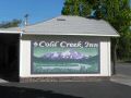
Stayed overnight at Cold Creek Inn.
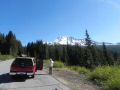
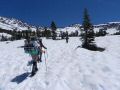
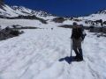
Day 2: Backpacked
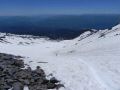
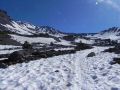
from Bunny Flat TH (6940 ft elev) to Lake Helen (10443 ft elev).
3.5 miles one way with 3500 elev gain.
Day 3: Summit Mt
Shasta (14179 ft). 3.8 miles roundtrip
with 3740 elev gain.
Day 4: Hiked out
and drove back home. 3.5 miles one way
with 3500 ft elev loss.
We had a couple of backup days at the Lake Helen for a possible inclement weather but luckily we did not need the backup dates. All 4 days were near perfect days. At such a high altitude (over 10,000 ft), there is always a chance for temporary bad condition such as the lenticular clouds. The lenticular clouds can cause strong wind and high precipitation which are not ideal condition for climbing a high altitude mountain. There were some mountain wind at the Lake Helen basecamp over the night but, in general, weather wan near perfect during our climb. On the way to Lake Helen, it was blue sky with 60F and almost no wind. On the summit day, it was a bit chilly near 30s at 0200am but quickly warmed up to 50s.
Cost for the trip (Total of 53+40+5+15+15+5+4+20+30 =
$187):
a. Gas & Toll bridge:
$53. Noel's car (98 Camry) was
efficient at 30miles / Gallon.
We drove about 1100 miles round trip.
Three of us shared the gas.
b. Lodging: $40 at
Cold Creek Inn. Each of us had a bed.
c. Food. Subway
lunch: $5. Pizza Dinner in Shasta City:
$15. Breakfast: $15.
Subway lunch on the way home: $6.
Pizza dinner: $4.
d. Climbing fee: $20.
e. Cost for backpacking (fuel, snacks, food, etc):
estimated at $30.
f. Cost for backpacking gears and equipment for
semi-technical climbing: Not counted
.
Day 1 (Sunday, Drove to Shasta City. 10 hours of driving. Stayed overnight at Cold Creek Inn.):
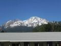
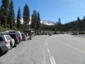
Six climbers (Tom R, Tom H, Chris, Noel, Fred, and Isaac) were gathered at Tom's house, Port Orchard. Tom R, Chris, Fred, and I carpooled from Tom's house. Previous arraignment were made for 9 climbers to carpool in 3 groups: 1. Tom H, Tom R, $ Chris. 2. Fred, Noel, & Isaac, 3. Cheryl, Jack, & Geno (had a separate trip itinerary). Six of us left Port Orchard at 0750 and arrived at Shasta City at 1730. It was about 10 hour of driving at 590 miles with a couple of stops for rest, gas, and food. We stayed overnight at Cold Creek Inn, Shasta City It was a nice place at a reasonable cost of $40 each. Each of us had a bed. From the Cold Creek Inn parking lots, we could see the majestic Mt Shasta. We talked to several climbers who just climbed. One of them mentioned that there were 60 climbers on Saturday or Sunday. The guided trip party climbed the mountain by roping up and going left of the Red Banks to avoid the debris falling from above in steep chute of the Red Banks. On Sunday, the Lake Helen area was so crowded that many climbers camped below the Lake Helen.
|
|
|
|
|
|
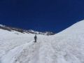
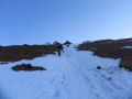
Day 2 (Monday, Backpacked to Lake Helen. It was about 3.5 miles one way with 3500 ft
elev gain):
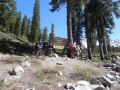
Had a nice "Huge" breakfast at "Black Bear
Inn" at 0800. Around 1000,
we started to backpack from Bunny Flat TH to Lake Helene
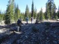
(3.5 miles with 3503 ft elev gain).
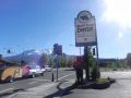
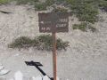
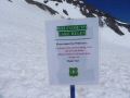
The climbing permit cost was $20 at the TH by self-registration.
It looked like it was free for the Gold Eagle Pass Cardholders. We
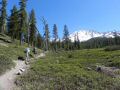
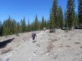
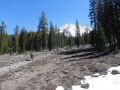
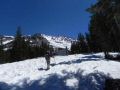
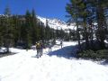
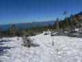
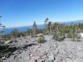
took our time as we would be exposed to the Sun above the tree line (about 8000 ft elev). It was an excellent and well
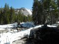
maintained trail surrounded by Mt Shasta red fir and some
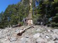
other ever green trees. When we were at
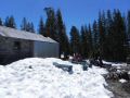
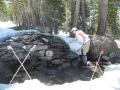
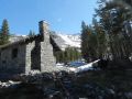
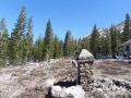
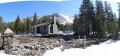
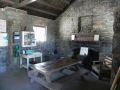
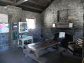
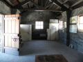
the Horse Camp (2 miles from TH, 8,000 ft elev), we helped the ranger store away the winter
panels at the horse camp building which was built in 1940s. Above the Horse camp, we were
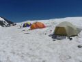
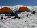
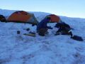
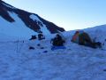
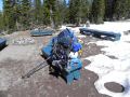
exposed to the Sun and were on the snow from there. At the Lake,
there were many camp sites available since it was a
weekday. Most of the climbers were moving out. It was warm around 50s in the afternoon.
Temp did not plunge badly during the night but the wind
chill factor probably dropped to mid 30s. The mountain wind was quite strong that
flapped the rain cover throughout the night.
I could not sleep at all through the night because my new air mattress provided poor insulation. I felt like I was laying on the semi-ice sheet. Prior to this trip, I have been using the Thermo rest mattress which was pretty good on the snow but was narrow for my shoulders. Prior to the trip, I bought an air mattress that was wider and appeared to be comfortable. I wore 4 layers of shirts but was still freezing. For the first time in backpacking, I experience the bitter coldness throughout the night. It was a good lessons learned for me. If I am backpacking on the snow, I will need to carry an additional form mattress to get better insulation from the snow floor. Next night, I slept well placing my blue tarp and an extra clothes under the air mattress.
|
|
|
|
|
|
|
|
|
|
|
|
|
|
|
|
|
|
|
|
|
|
|
|
|
|
|
|
|
|
|
|
|
|
|
|
|
|
|
|
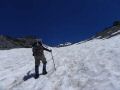
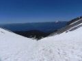
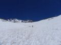
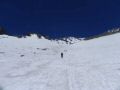
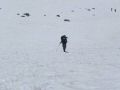
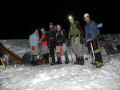
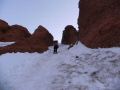
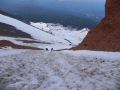
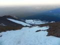
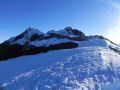
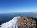
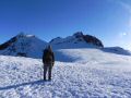
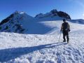
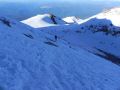
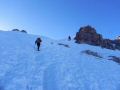
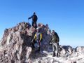
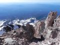
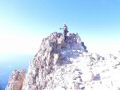
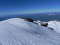
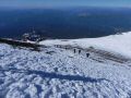
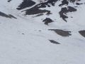
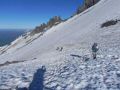
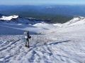
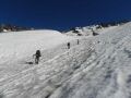
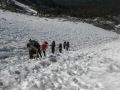
Day 3 (Tue, Climbed Mt Shasta. It was about 3.8 miles roundtrip with 3740 ft elev gain): Woke up at 0200 with no sleep through the night. Started climbing at 0320: 3.8 miles roundtrip with 3736 ft elev. Like any other mountain claiming, it was like walking on a stair master, one step at a time. I really enjoy its moment, not like walking out on a stair master at a gym but it's the feeling of working out on a stair master in a wilderness with cold air, rugged trail, mind concentration, etc. Fred reached the summit before 0700. Tom H and I reached there around 0715, It was quite short but very steep (I think that it's twice steep as the Camp Muir snowfield). It was probably the toughest climb among my 5 volcanic climbs over 10,000 ft.
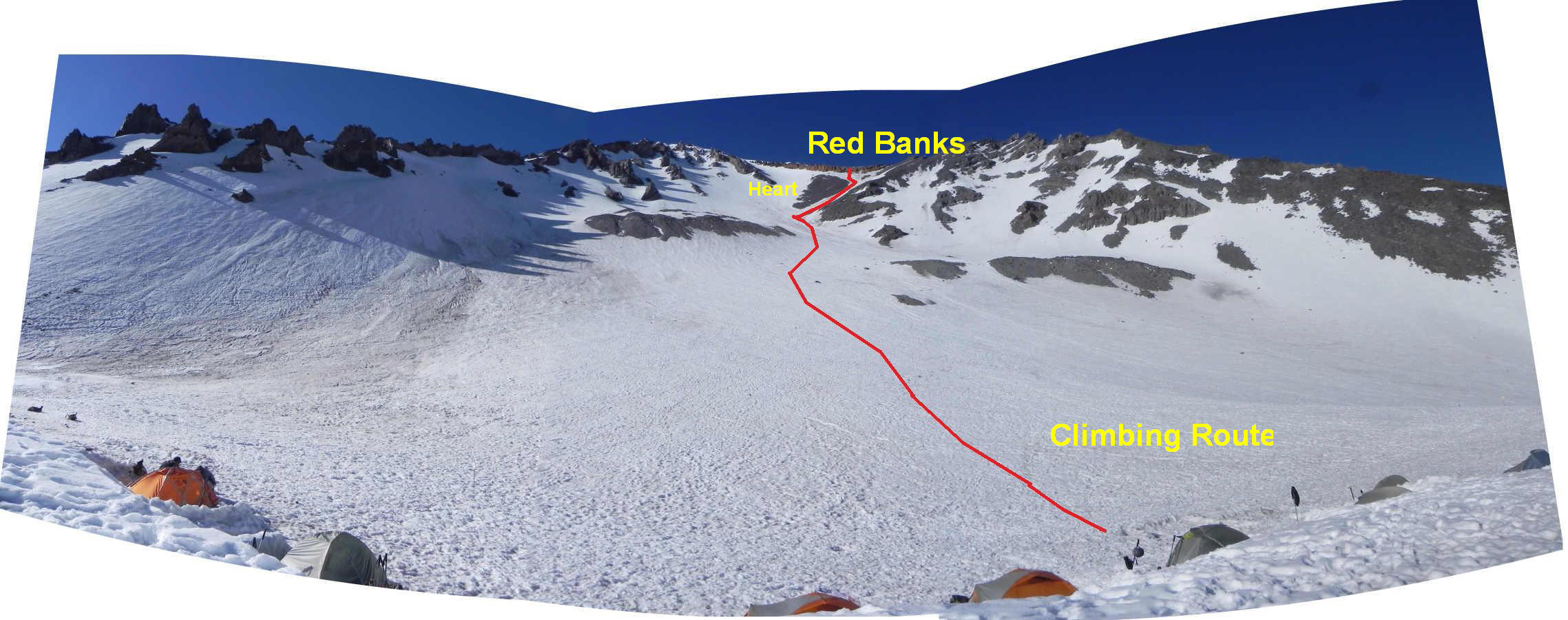
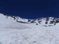
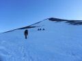
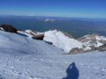
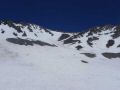
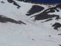
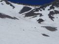
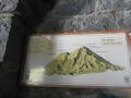
From the Lake Helen camp site, we continued up on the Avalanche Gulch on the right of the "Heart". The exposed rocks just below the "Red Banks looks like a "heart." Just passed the Heart, we again headed straight up to Red Banks. The steep chute in the Red Banks was the most DICEY SPOT during the entire trip. That's where Chris (One of PWC climbers) fell and injured her finger while descending. The top of the Red Banks is at 12,800 ft elev. The Red Banks looked like a wall of red dirt but it is a prominent exposure of orange welded pumice that was one of the volcano's most recent products. For the summit route of the day (early in the morning), there were 2 climbers above me: Fred and one other climber. Fred was very strong and long gone well ahead of me and Tom H. I could speed up but wanted to keep my distance visible from the group below me. The other climber who left the Bunny Flat TH at 0130 was dayhiking from the TH. He passed me well below the Red Banks. Then, going up the steep chute of the Red Banks, I got hit by a snow ball (golf ball size) on top of my left shoes. I did not get warning or anything since both Fred and the other climber were long gone up. My left foot was hurting but was really lucky that I did not get hit on my face or other part of exposed body. On top of Red Banks, Tom H and I rested for a while. Then, my blue sitting pad was blown away by wind that I forgot to secure as I got up. After the Red Banks (12,800 ft) is a plateau at about 13,200 ft elev.
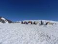
Next climb up is about 500 ft elev gain to Misery Hill. At the Misery Hill, we could finally see the pointy Mt Shasta summit to the right for the first time. As we hiked across another plateau and another short climb leads to the summit. During the entire climbing, we had our CRAMPONS on, except for glissading down just below the Red Banks. Tom H and I took our time waiting for the snow to melt so that we could glissade. We arrived at the camp site around 1100. Fred arrived earlier. Cheryl's party arrived around 1130. Tom R, Chris, and Noel arrived at 1500. Tom H applied the First Aid to Christ's finger at the camp site. I turned in early at 1800 for next day.
|
|
|
|
|
|
|
|
|
|
|
|
|
|
|
|
|
|
|
|
|
|
|
|
|
|
|
|
|
|
|
|
|
Day 4: Hiked out and drove back home (3.5 miles one way with 3500 ft elev loss, 10 hours of driving about 550 miles). We woke up to another beautiful day at 0530 and left the Lake Helen Camp Site at 0720. Next stop was the Horse Camp (1.5 miles away from Lake Helen) where it had a re-fill water station and benches to sit down. Six of us arrived at the Bunny Flat TH around 1130 and headed home around 1200. Fred, Noel, and I stopped by at the Shasta City where Fred bought a Mt Shasta patch at a souvenir store. We left the Shasta City at 1240. We made one stop for food and gas. Fred was a near vegetarian and wanted to eat at a Quzuno. We pulled out to the Roseburg City where Noel's car was also low in fuel. The Quizuno was closed and ended up at a Sunway for a sub. Well, we ended up at the SAME subway store in Roseburg where we stopped by on the way down to Shasta City !!! We arrived at Port Orchard around 2115 about 45 minutes earlier than Tom's group. We all safely arrived at Tom's house after about 10 hours of driving.
|
|
|
|
|
|
|
|
|
|
|
|
|
|
|
|
|
|
|
|
|
|
|
|
|
|
|
|
|
|
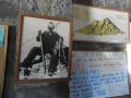
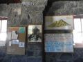
Pictures from Tom Henning:
|
|
|
|
|
|
|
|
|
|
|
|
|
|
|
|
|
|
|
|
|
|
|
|
|
|
|
|
|
|
|
|
|
|
|
|
|
|
|
|
|
|
|
|
|
|
|
|
|
|
|
|
|
|
|
|
|
|
|
|
|
|
|
|
|
|


_tm.jpg)
_tm.jpg)
_tm.jpg)
_tm.jpg)
_tm.jpg)
_tm.jpg)
_tm.jpg)
_tm.jpg)
_tm.jpg)
_tm.jpg)
_tm.jpg)
_tm.jpg)
_tm.jpg)
_tm.jpg)
_tm.jpg)
_tm.jpg)
_tm.jpg)
_tm.jpg)
_tm.jpg)
_tm.jpg)
_tm.jpg)
_tm.jpg)
_tm.jpg)
_tm.jpg)
_tm.jpg)
_tm.jpg)
_tm.jpg)
_tm.jpg)
_tm.jpg)
_tm.jpg)
_tm.jpg)
_tm.jpg)
_tm.jpg)
_tm.jpg)
_tm.jpg)
_tm.jpg)
_tm.jpg)
_tm.jpg)
_tm.jpg)
_tm.jpg)
_tm.jpg)
_tm.jpg)
_tm.jpg)
_tm.jpg)
_tm.jpg)
_tm.jpg)
_tm.jpg)
_tm.jpg)
_tm.jpg)
_tm.jpg)
_tm.jpg)
_tm.jpg)
_tm.jpg)
_tm.jpg)
_tm.jpg)
_tm.jpg)
_tm.jpg)
_tm.jpg)
_tm.jpg)