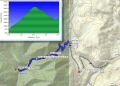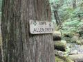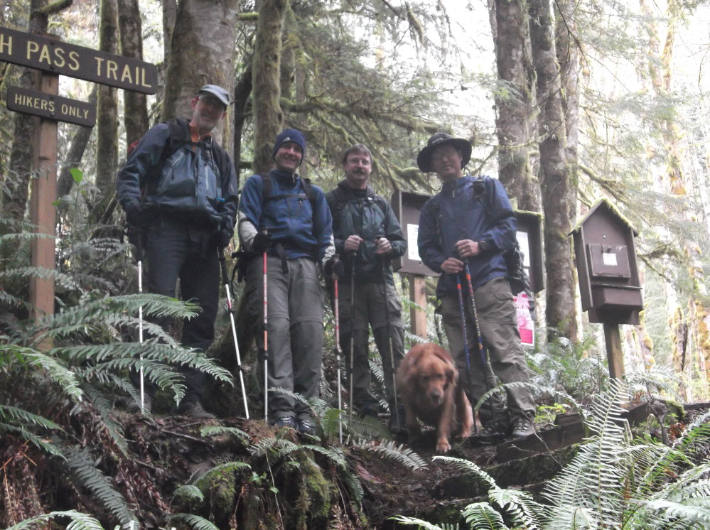
Hiking Notch Pass Trail, Fri, 4-12-2013, 8.2 miles with 3000 ft elev gain. (0820-1220)
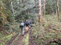
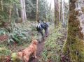
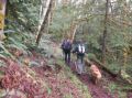
I have heard of the trail many times and have wanted to hike its trail someday. Originally, Les and I wanted to ski/snowshoe the Camp Muir but the weather did not look good. So, we ended up doing a moderate hike. Paul and Bill (a new comer) joined us for the hike. Weather forecast with impending rain at 1100, the Notch Pass trail seemed to be fine since the highest point was around 2400 ft elev. All of us (Les, Paul, Bill, Tippy, and I) except Paul, it was the first time hiking the trail. All of us were in good shape and had fun. It started drizzling around 1200 (near the end of our hiking), and got heaver when we started driving back.
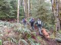
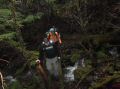
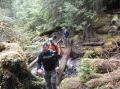
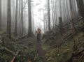
It was cloudy and foggy at high 30 and maybe at low 40s. Indeed, the whole trail was pretty much "in the wood." The trail climbed from the foothills above Quilcene through dense, dark forest, to a low "notch" along the ridge of a mountain (it's also called Green Mt, the same name as the local mountain in the Seabeck). After the Pass, there were lots of down trees that included massive fallen tees in one place. Although there was no views, it was a nice trail in the wood with abundant fresh air and earful of flowing little creeks and the Big Quilcene River.
Here is a summary of our hiking (0820-1220):
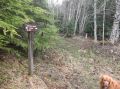
a. Notch Pass Trailhead (680 ft elev). Driving to the trailhead could
be quite tricky. Needed a higher clearance car. My van was banged
up on the bottom a few times.
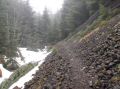
b. The trail up to the Notch Pass was in excellent condition with a few
minor fallen trees. The Notch Pass was at 4.1 miles from the trailhead
at 2400 elevation.
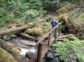
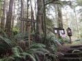
c. After the pass, we came across a massive pile of fallen trees.
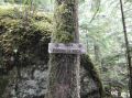
Trail was re-routed with the flags that we did not notice.
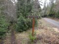
d. We crossed 1 of 2 roads. It was a well maintained dirt road
but appeared that none of us has been driving on that road
e. We crossed 2 of 2 roads. It was the paved portion to the Upper
Big Quilcene Trailheads (Mt Townsend, Tunnel Creek, & Marmot Pass.)
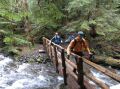
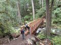
f. Crossed 2 bridges.
g. Reached the junction with the Lower Big Quilcene trail at the newly
built bridge near the Bark Shanty. 4.1 miles at 1550 ft elev.
h. Cross country back to the Notch Pass trailhead.
In overall, it was a nice hike on a decent trail, It's also a good conditioning hike in the Winter/early Spring if one can access the trailhead. A high clearance car is recommend to get to the trailhead.
|
|
|
|
|
|
|
|
|
|
|
|
|
|
|
|
|
|
|
|
|
|
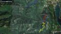
Direction to Trailhead:
It can be confusing. All are estiamted distances.
Refer to the GPS track data (Drive 1.5 miles on the Penny Creek Road, Shart
Left turn and drive about 0.8 miles. Turn right and drive about
1.4 miles.).