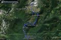
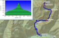
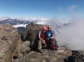
Day hiking the Brothers Mt (South Peak, 6846 ft), Sun (8-18-2013), 17.1 miles roundtrip with 6500 ft elev gian.
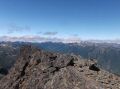
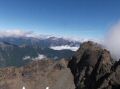
For the weekend, Les wanted to dayhike the South Peak (6846 ft) of the Brothers Mt which he has not climbed yet and we talked about it before. He skied the East side of the Mountain last year but has not hiked the summer route. I climbed the south peak as an overnigher on all snow routes with the PWCers in April 2011 but also wanted to day hike the summer route without snow. We planned to hike the Mountain two days earlier but the weather delayed our hike. Three peaks, The Brothers Mt, Mt Jupiter, and Mt Constance are probably the most prominent peaks that can be seen across the Puget Sound, Seattle. Interestingly, I could not find its overall technical specs on the web (but I am sure it's there). My GPS data showed 17.1 miles with estimated 6500 ft elev gain. My GPS (Garmin DaKota 10) does not calculate the total ascent, so I had to use its data to estimate manually. Dakota 20 model does calculate total ascent for the trip. It was a lot tougher dayhike than I thought due to its rugged routes (bushwhacks, steep rocky ravine, steep loose shale). Route finding was minimal as there were some boot tracks and boot beaten path. The general routes were the same as the winter route. The summer routes are well described on the Olympic Climber's Guide.. Time spent was 0500 -1730. Spent 1/2 hour at the summit with 3 other climbers. Also spent about 1 hour munching on lots of "tarts" (blueberries) along the trail before and after the Climbers' camp site.
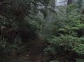
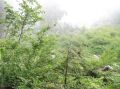
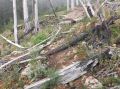
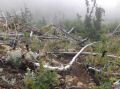
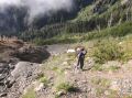
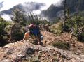
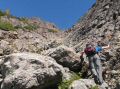
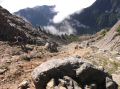
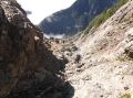
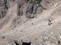
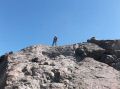
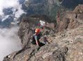
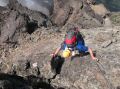
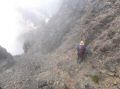
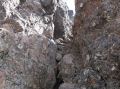
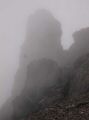
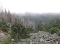
There were 4 separate climbing parties including us: 1 couple, 1 solo (who works for a guiding service in Seattle), 4 climbers, and us. On the way down, two climbers were taking a break at the Lunch Rock. From the Lena Lake trailhead, we hiked about 1 hr with headlamps as it was pitch dark on the well maintained trail under the green canopy. We quietly pass through the Lena Lake camp sites, passed just a little beyond the Climbers Camp site, got back on the foot beaten path around the Climbers' camp site, passed the avalanche area (where we camped on the snow in 2011), passed through the forest burnt reminiscent area , hiked up the steep rocky ravine, continued up on the loose shale route toward west of Lunch Rock, traversed to the Lunch Rock, followed a descent route up, slowly traversed to the gulley (falling rock danger), ascent the 1st gulley one climber at a time, ascent the 2nd gulley one climber at a time, climbed up the 60 degree pitch Hourglass (loose shale), missed the path to the true summit on the right in the Hourglass, arrived at the false summit, and traversed to the True summit. Traversing to the True Summit, I thought it was class 2 (maybe low 3) since it was not exposed to the shear cliff, but the other climbers mentioned that it was a lower end of class 4 ! At the True South summit, we saw the 4 climbers who were at the false summit opted to go back down the mountain not traversing to the true summit (which took us less than 10 minutes). So, I guess it was maybe class 4. In overall, it was quite a bit of work for a dayhike. I felt great as I have been enjoying strenuous hikes in the last several weekends. Les was also in great shape since he just came back from 10 days of Canadian Rockies trip about 3 weeks ago. He set the pace for the entire trip and never slowed down.
A short summary of summer routes description (This is not
the climbing instruction but for your info only. Always use the Olympic Climber's
guide): Not recommend when the routes are wet. The routes above the Climbers
Camp Site needed to be dry for safety.
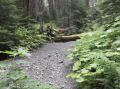
1. Lena Lake
trailhead (xxx ft elev) to the Lower
Lena Lake ( xxx ft elev). Maintained
trail. 0 miles /3.2 miles TOTAL.
2. Valley of Silent Man (xxx ft elev). Maintained trail. It was absolutely tranquil. Creek was dry. Looks like water was flowing underneath some
place. xx miles /4.5 miles.
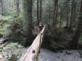
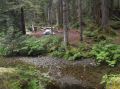
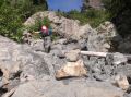
3. To the Climbers Camp site. Maintained trail. It had many odd shaped camp grounds. Started to hear the creek flowing. Turn left
at the first camp side by crossing the creek (shallow, no foot bridge). Xx miles/6.2 miles.
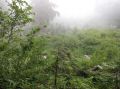
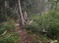
4. 1/4 miles of
fainted trail (scant boot path) that ends at the ravine with rocks. Xx
miles / xx miles.
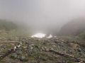
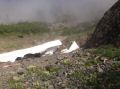
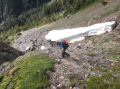
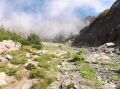
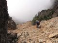
5. Go up and up along the ravine. Had some cairns markings but they
wont' be there after the winter. Xx miles / xx miles.
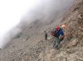
6. Before the headwall at 5000 ft elev, need to traverse to the Lunch
Rock, then head up on a clear route. Head toward left of the false
summit. Xx miles /
xx miles.
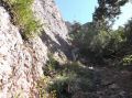
7. Steep Loose
shale and avalanche rock route. Enter
the first Gully (40 degree slope, falling rock danger) for 500 ft
vertical gain, 2nd Gulley, and Hourglass.
Xx miles / xx miles.
8. Face the steep
slope (60 degree slope) before the false summit. Go up left toward the false summit, there is a rock gap in the Hourglass
to the East that will lead to the true summit. We did not know about
it and went to the false summit. Xx miles / xx miles.
9. If ended up on
the false summit, one can go back down
and up, or traverse (up to Class 3 or 4) to the true summit (that's
what we did.). xx miles / xx miles
In overall, it was an excellent dayhike that I really liked for the weekend hike. Weather was not sunny but descend enough that the routes were all dry (should not try if wet). We were pleased to summit the Mountain on the summer "routes" for the first time. Also, it was sort of one of my training hikes prior to Bailey Range Traverse (13-17 Sept).
|
|
|
|
|
|
|
|
|
|
|
|
|
|
|
|
|
|
|
|
|
|
|
|
|
|
|
|
|
|
|
|
|
|
|
|
|
|
|
|
|
|
|
|
|
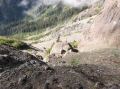
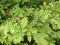
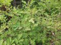
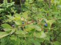
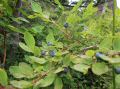
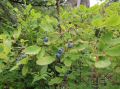
Blueberry and Salmon Berry Festival just below and above Climber's Camp Site:
|
|
|
|
|
|
|
|
Trailhead Direction:
Coming from Hoodsport, just past the town of Hamma Hamma turn left at Hamma Hamma Recreational Area sign. Follow
the road for several miles past the trailhead for the Lena Lake (Lower and Upper Lena Lakes, The Brohters MT, etc).
For
the Puvin Trailhead (Lake of the Angles & Mildred Lakes):
Road will become gravel and in some places were very bumpy, so take it slow. The Putvin Trail sign is about 4 miles pass the Lena Lake trailhead (8 miles in), on the right. Hard to see, so drive fairly slow.