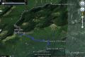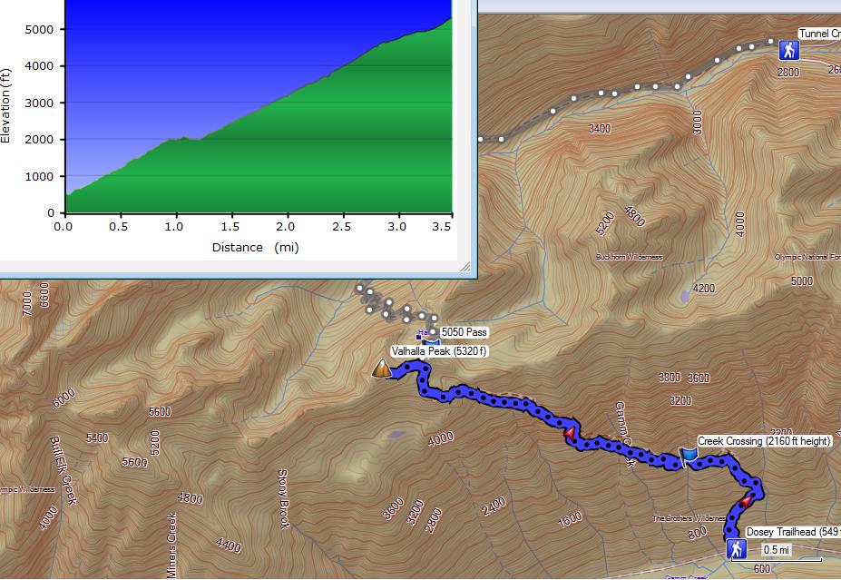
Hiking Valhalla Peak (Beyond 5050 Pass) from Dosey Road (Sun, 6-30-2013) - At least 7 miles roundtrip with 4800 ft elev gain.
The 2013 summer officially started on Fri, 21 June but the weather has been a lot different from the previous years (the worst start of the summer so far since 2006). It has been overcast or for the last 3 weeks. On some days, it rained all day !!! Then, the weather turned around all sunny on Friday, 28 June. It hit mid 80s for the first time this summer. Then, supposed to hit 90s on Monday, 1 July. I wanted do a conditioning hike before the Mt Rainier Climb on the following week, 8-10 July. A PWC member (Charlie Pomfret) and I decided to hike the 5050 pass form the Dosewallips Trailhead. It's a short but tough hike, 6.4 miles with 4500 ft elev gain. We have been mountain biking once in a while in the fall and winter last year.
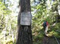
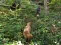
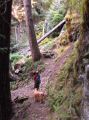
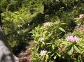
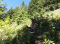
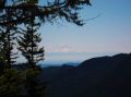
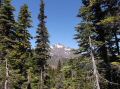
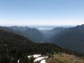
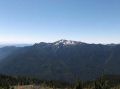
I hiked the trail once back in Nov 2011 and it was the third for Charlie (who has been hiking/backpacking/climbing over 25 years !.) Its trail was rated as "Extreme" on the "Day Hike !" book that was authored by Seabury Blair Jr. To me, this book is a must to have for the Olympics hikers (The other book is the Olympic Mountains Trail Guide by Robert Wood). There are only 4 hikes in the book rated as "Extreme" out of 71 day hikes. He has 5 ratings: easy, moderate, moderately difficult, difficult, and Extreme. We arrived at the Dosey Road TH around 0825 and started hiking about 0835. Temp was mild at 50s. Both of our GPS units were not receiving enough satellites for good positional fixes. The TH elevation supposed to be around 500 ft but my GPS indicated 2200 ft and the current position was way off from the trailhead. Its trail was steep right off the trailhead. Charlie set the pace going up the trail. We took a 10 minutes break every hour or so. Its trail needed maintenance soon. The trail had lots of down trees in the lower section (but easy to walk over or around), and had over grown bushes pretty much all along the trail. The first 2 miles (with about 3500 ft elev gain) are pretty much under the tree canopy and had a peekaboo view of the Mt Jupiter to the South across the Dosewallips Valley along with the Mt Rainier in the distance. Near the 4500 ft elev, The Brothers Mt comes to a view once in a while. The upper trail (above 4000 ft elev) was loaded with bear grass and some late blooming Rhodies.
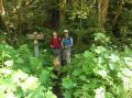
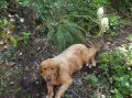
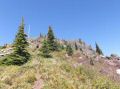
When we arrived at the 5050 Pass, Charlie wanted to take me to the Valhalla Peak that I was not aware of. I knew that there was some way trail above the 5050 Pass but did not know how far one could go up without bushwhacking. In my surprise, the trail from 5050 Pass to Valhalla Peak was well established. It was about 0.3 miles one way with 300 ft elev gain. Charlie mentioned that there used to be a Valhalla Peak sign at the summit but it disappeared. Going up the last 100 ft to the Valhalla Peak, I finally felt some thigh burns that slowed me down. Charlie was strong and long gone waiting for me at the summit. It took us about 3 hours for 3.5 miles one way with 4800 ft elev gain !!! I think that was excellent as I was carrying about 22 LBs of water for me and Tippy (our family dog). It sure felt like more than 4 miles one way. Its one distance of 3.5 miles was estimated using the US forest website info: 3.2 miles from the Dosey Road to the 5050 Pass. My GPS had some intermittent signal reception that shorten the distance quite a bit. Its recording skipped a lot of switch backs.
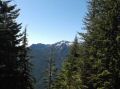
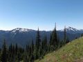
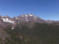
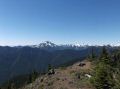
The views at the Valhalla Peak was spectacular, in clockwise from Mt Constance: Mt Constance, Iron Mt, Buckhorn Mt, Mt Townsend, Mt Baker, Glacier Peak, Mt Rainer, Mt Jupiter, The Brothers Mt, Mt Lena, Mt Stone, & Del Monte Ridge (Constance Pass). Our trip of downhill was sort of uneventful but needed lots of attention for proper footing due to its steep trail. We left the summit just pass the noon and arrived back at the TH at 1430. Temp was near 80s but did not feel really hot due to some breeze. It was a nice workout and a fun hike. Thanks to Charlie for the excellent hike.
|
|
|
|
|
|
|
|
|
|
|
|
|
|
|
|
|
|
|
|
|
|
|
|
|
|
|
Trailhead Direction:
On HWY 101 from Quilcene about 11 miles to the City of
"Brinnon", turn right on
Dosewallips Road. The right turn comes
right after the slight turn, so needs to pay attention. Its TH is at 9.6 miles. The first 8
miles are paved. Its trailhead is just before (300 ft before
the washout).